കൊട്ടാട്ടി
കൊട്ടാട്ടി, അമേരിക്കൻ ഐക്യനാടുകളിലെ കാലിഫോർണിയ സംസ്ഥാനത്തെ സൊനോമ കൗണ്ടിയിൽ സ്ഥിതിചെയ്യുന്ന സംയോജിപ്പിക്കപ്പെട്ട ഒരു നഗരമാണ്. ഇത് സാൻഫ്രാൻസിസ്കോയ്ക്ക് വടക്കുഭാഗത്തായി ഏകദേശം 45 മൈൽ (70 കിലോമീറ്റർ) ദൂരെയായി റോഹ്നർട്ട് പാർക്കും പെറ്റാലുമയും തമ്മിലുള്ള 101 ഇടനാഴിയിലാണു സ്ഥിതിചെയ്യുന്നത്. 2010 ലെ സെൻസസ് പ്രകാരം 7,265[10] ജനസംഖ്യയുള്ള ഈ നഗരം, സൊനോമ കൗണ്ടിയിലെ ഏറ്റവും ചെറിയ ഏകീകരിക്കപ്പെട്ട സമൂഹമാണ്. സൊനോമ കൗണ്ടി മുഴുവനായെന്നപോലെ കൊട്ടാട്ടി നഗരവും സാൻ ഫ്രാൻസിസ്കോ ഉൾക്കടൽ മേഖലയിലും റെഡ്വുഡ് എമ്പയറിലും ഉൾപ്പെട്ടിരിക്കുന്നു.
കൊട്ടാട്ടി നഗരം | ||
|---|---|---|
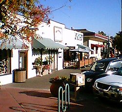
 Cotati downtown scene | ||
| ||
| Nickname(s): The Hub of Sonoma County[1] | ||
 Location of Cotati in Sonoma County, California. | ||
 City boundaries as of 2000 | ||
| Coordinates: 38°19′40″N 122°42′33″W / 38.32778°N 122.70917°W[2] | ||
| Country | ||
| State | ||
| County | Sonoma | |
| Incorporated | July 16, 1963[3] | |
| നാമഹേതു | Rancho Cotate | |
| • Mayor | John C. Moore[4] | |
| • City manager | Damien O'Bid[5] | |
| • ആകെ | 1.88 ച മൈ (4.88 ച.കി.മീ.) | |
| • ഭൂമി | 1.88 ച മൈ (4.87 ച.കി.മീ.) | |
| • ജലം | 0.00 ച മൈ (0.01 ച.കി.മീ.) 0.17% | |
| ഉയരം | 112 അടി (34 മീ) | |
| • ആകെ | 7,265 | |
| • കണക്ക് (2016)[8] | 7,455 | |
| • ജനസാന്ദ്രത | 3,965.43/ച മൈ (1,531.11/ച.കി.മീ.) | |
| California Department of Finance estimate | ||
| Demonym(s) | Cotatian | |
| സമയമേഖല | UTC−8 (Pacific Time Zone) | |
| • Summer (DST) | UTC−7 (PDT) | |
| ZIP codes[9] | 94926–94928, 94931 | |
| Area code | 707 | |
| FIPS code | 06-16560 | |
| GNIS feature IDs | 1655927, 2410240 | |
| വെബ്സൈറ്റ് | ci | |
അവലംബം
തിരുത്തുക- ↑ Draper, p. 8
- ↑ 2.0 2.1 "City of Cotati". Geographic Names Information System. United States Geological Survey. Retrieved February 25, 2015.
- ↑ "California Cities by Incorporation Date". California Association of Local Agency Formation Commissions. Archived from the original (Word) on November 3, 2014. Retrieved July 2, 2013.
- ↑ ഉദ്ധരിച്ചതിൽ പിഴവ്: അസാധുവായ
<ref>ടാഗ്;cityCouncilഎന്ന പേരിലെ അവലംബങ്ങൾക്ക് എഴുത്തൊന്നും നൽകിയിട്ടില്ല. - ↑ "City Manager / City Clerk". City of Cotati. Retrieved May 16, 2015.
- ↑ "2016 U.S. Gazetteer Files". United States Census Bureau. Retrieved Jul 19, 2017.
- ↑ "E-1 Population Estimates for Cities, Counties, and the State — January 1, 2015 and 2016". California Department of Finance. May 2016. Archived from the original on 2020-06-10. Retrieved November 27, 2016.
- ↑ ഉദ്ധരിച്ചതിൽ പിഴവ്: അസാധുവായ
<ref>ടാഗ്;USCensusEst2016എന്ന പേരിലെ അവലംബങ്ങൾക്ക് എഴുത്തൊന്നും നൽകിയിട്ടില്ല. - ↑ "ZIP Code(tm) Lookup". United States Postal Service. Retrieved November 20, 2014.
- ↑ "Census 2010: Table 3A — Total Population by Race (Hispanic exclusive) and Hispanic or Latino: 2010". California Department of Finance. Archived from the original (Excel) on ഡിസംബർ 3, 2013. Retrieved മാർച്ച് 22, 2010.
