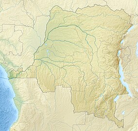
വിരുംഗ ദേശീയോദ്യാനം
വിരുംഗ ദേശീയോദ്യാനം (ഫ്രഞ്ച്: Parc National des Virunga), 7,800 ചതുരശ്ര കിലോമീറ്റർ (3,000 ചതുരശ്ര മൈൽ) വിസ്തീർണ്ണമുള്ളതും തെക്കുഭാഗത്ത് വിരുംഗ മലനിരകൾ മുതൽ വടക്കുഭാഗത്ത് റ്വെൻസോറി മലനിരകൾ വരെയും വ്യാപിച്ചു കിടക്കുന്ന കിഴക്കൻ ഡെമോക്രാറ്റിക് റിപ്പബ്ലിക്ക് ഓഫ് കോംഗോയിലെ ഒരു ദേശീയോദ്യാനമാണ്. ഇത് റുവാണ്ടയിലെ വോൾക്കാനോസ് ദേശീയോദ്യാനം, ഉഗാണ്ടയിലെ റ്വെൻസോറി ദേശീയോദ്യാനം, ക്യൂൻ എലിസബത്ത് ദേശീയോദ്യാനം എന്നിവയുമായി അതിർത്തി പങ്കിടുന്നു. ഈ ദേശീയോദ്യാനം നേരത്തേ ആൽബർട്ട് ദേശീയോദ്യാനം എന്നാണറിയപ്പെട്ടിരുന്നത്.
| Virunga National Park | |
|---|---|
ഐ.യു.സി.എൻ. ഗണം II (ദേശീയോദ്യാനം) | |
 Bukima Camp in the foothills of Mikeno Mountain, home of the Congolese mountain gorillas | |
| Location | Democratic Republic of the Congo |
| Nearest city | Goma |
| Coordinates | 0°55′S 29°10′E / 0.917°S 29.167°E |
| Area | 7,800 കി.m2 (3,000 ച മൈ) |
| Established | 1925 |
| Governing body | Institut Congolais pour la Conservation de la Nature |
| Type | Natural |
| Criteria | vii, viii, x |
| Designated | 1979 (3rd session) |
| Reference no. | 63 |
| State Party | |
| Region | Africa |
| Endangered | 1994–present |
1925 ൽ ആഫ്രിക്കയിലെ ആദ്യത്തെ ദേശീയോദ്യാനമായി സ്ഥാപിക്കപ്പെട്ട ഇത് 1979 മുതൽ യുനെസ്കോയുടെ ലോക പൈതൃക സ്ഥലമായി അംഗീകരിക്കപ്പെട്ടിരിക്കുന്നു.
