പ്രമാണം:Malabar 1854.jpg
പൂർണ്ണ വലിപ്പം (5,259 × 6,171 പിക്സൽ, പ്രമാണത്തിന്റെ വലിപ്പം: 18.28 എം.ബി., മൈം തരം: image/jpeg)
| ഈ പ്രമാണം വിക്കിമീഡിയ കോമൺസിൽ നിന്നുള്ളതാണ്. പ്രമാണത്തെക്കുറിച്ചുള്ള വിവരണം താഴെ കൊടുത്തിരിക്കുന്നു.
|
ചുരുക്കം
| Description |
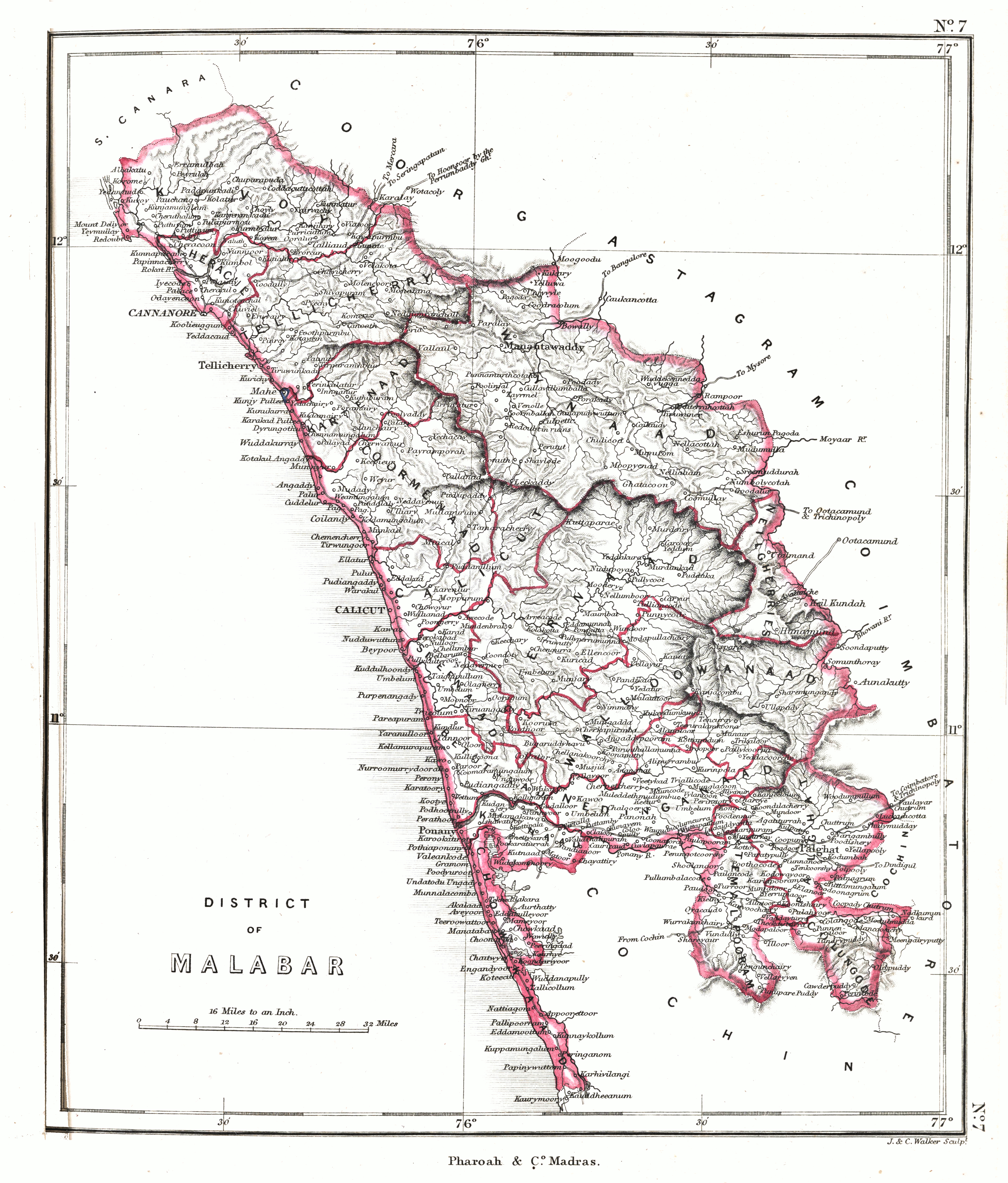
Malabar region ca. 1854 |
|||||||||
| തീയതി | ||||||||||
| സ്രോതസ്സ് | An atlas of the southern part of India : including plans of all the principal towns and cantonments, reduced from the Grand trigonometrical survey of India showing also the Tenasserim Province | |||||||||
| സ്രഷ്ടാവ് |
J. & C. Walker; Pharoah and Co. Madras |
|||||||||
| അനുമതി (ഈ പ്രമാണത്തിന്റെ പുനരുപയോഗം) |
|
|||||||||
| Geotemporal data | ||||||||||
| Bounding box |
|
|||||||||
| Georeferencing | ||||||||||
പ്രമാണ നാൾവഴി
ഏതെങ്കിലും തീയതി/സമയ കണ്ണിയിൽ ഞെക്കിയാൽ പ്രസ്തുതസമയത്ത് ഈ പ്രമാണം എങ്ങനെയായിരുന്നു എന്നു കാണാം.
| തീയതി/സമയം | ലഘുചിത്രം | അളവുകൾ | ഉപയോക്താവ് | അഭിപ്രായം | |
|---|---|---|---|---|---|
| നിലവിലുള്ളത് | 06:06, 29 ജനുവരി 2020 | | 5,259 × 6,171 (18.28 എം.ബി.) | Shyamal | {{Map |Description=Malabar region ca. 1854 |Source=[https://searchworks.stanford.edu/view/12089476 An atlas of the southern part of India : including plans of all the principal towns and cantonments, reduced from the Grand trigonometrical survey of India showing also the Tenasserim Province] |Date=1854 |Author=J. & C. Walker; Pharoah and Co. Madras |Permission={{pd-old-70}} |other_versions= }} Category:Maps of Kerala Category:Maps of South India |
പ്രമാണത്തിന്റെ ഉപയോഗം
താഴെ കാണുന്ന താളിൽ ഈ ചിത്രം ഉപയോഗിക്കുന്നു:
പ്രമാണത്തിന്റെ ആഗോള ഉപയോഗം
താഴെ കൊടുത്തിരിക്കുന്ന മറ്റ് വിക്കികൾ ഈ പ്രമാണം ഉപയോഗിക്കുന്നു:
- ar.wikipedia.org സംരംഭത്തിലെ ഉപയോഗം
- en.wikipedia.org സംരംഭത്തിലെ ഉപയോഗം