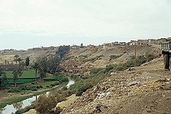
നാസ്ല
നാസ്ല ( അറബി: نزلة ; ഗാസ മുനമ്പിലെ വടക്കൻ ഗവർണറേറ്റിലെ പലസ്തീൻ പട്ടണമാണ് അൽ-നസ്ല, നസ്ലെ, അന്നസ്ല അല്ലെങ്കിൽ എൻ-നുസ്ലെ [1] ). മുമ്പ് മുനിസിപ്പാലിറ്റിയായിരുന്നുവെങ്കിലും അടുത്തുള്ള നഗരമായ ജബാലിയയുമായി ലയിപ്പിച്ചു. [2] ഗാസ സിറ്റിയിൽ നിന്ന് ഏതാനും കിലോമീറ്റർ വടക്കായി നസ്ല സ്ഥിതിചെയ്യുന്നു.
നാസ്ല نزلة Nazle | |
|---|---|
Town | |
| Al-Nazlah | |
 | |
| Coordinates: 31°31′58″N 34°28′56″E / 31.53278°N 34.48222°E | |
| Country | |
| Governorate | North Governorate |
| City | Jabalia |
ചരിത്രം
തിരുത്തുകബൈസന്റൈൻ- കാലഘട്ടത്തിലെ പട്ടണമായ അസാലിയയുടെ ( ഗ്രീക്കിൽ )αλέα) സ്ഥാനത്താണ് ഇന്നത്തെ നസ്ല എന്ന് കരുതപ്പെടുന്നു.. [3] [4] അക്കാലത്ത് ഗാസ നഗരത്തിലായിരുന്നു അസാലിയ. [3] ബൈസന്റൈൻ ഗാസയിലെ പ്രശസ്തനായ ഒരു ക്രിസ്ത്യൻ വ്യക്തി അസാലിയയിലെ അലാഫിയോൺ ആയിരുന്നു, അദ്ദേഹം ഭക്തനാണെന്ന് അറിയപ്പെട്ടിരുന്നു, കൂടാതെ പ്രദേശത്ത് ക്രിസ്തുമതം പ്രചരിപ്പിക്കാൻ സഹായിച്ച ആദ്യകാല മിഷനറിമാരിൽ ഒരാളായിരുന്നു അദ്ദേഹം. [5] ആറാം നൂറ്റാണ്ടിലെ മഡബ മാപ്പിൽ, അസാലിയയെ മൂന്ന് ഗോപുരങ്ങൾ, ഒരു ഗേറ്റ്, ഒരു മതിലിന്റെ ഒരു ഭാഗം എന്നിവ അടയാളപ്പെടുത്തിയിരിക്കുന്നു. [6]
ഓട്ടോമൻ യുഗം
തിരുത്തുക1863-ൽ ഫ്രഞ്ച് പര്യവേക്ഷകനായ വിക്ടർ ഗുറിൻ ഈ ഗ്രാമത്തിൽ 150 ഓളം നിവാസികളുണ്ടെന്ന് കണ്ടെത്തി. [7]
1870-ലെ ഒരു ഓട്ടോമൻ ഗ്രാമ പട്ടികയിൽ നസിലിന് 114 വീടുകളും 414 ജനസംഖ്യയുമുണ്ടെന്ന് കാണിക്കുന്നു, ജനസംഖ്യയിൽ പുരുഷന്മാരിൽ മാത്രം ഉൾപ്പെടുന്നു. [8] [9]
1883-ൽ പലസ്തീൻ പര്യവേഷണ ഫണ്ടിന്റെ സർവേ ഓഫ് വെസ്റ്റേൺ പലസ്തീൻ നസ്ലയെ ഒരു ചെറിയ കുഗ്രാമവും ജബാലിയയുടെ പ്രാന്തപ്രദേശവുമാണെന്ന് വിശേഷിപ്പിച്ചു. നസ്ലയുടെ കിഴക്ക് ഒരു കിണർ ഉണ്ടായിരുന്നു. [10]
ബ്രിട്ടീഷ് മാൻഡേറ്റ് യുഗം
തിരുത്തുക1922 ലെ ബ്രിട്ടീഷ് മാൻഡേറ്റ് അധികൃതർ നടത്തിയ സെൻസസ് പ്രകാരം നസ്ലയിൽ 694 ജനസംഖ്യയുണ്ടായിരുന്നു, എല്ലാവരും മുസ്ലിം മതസ്ഥർ, [11] 1931 ലെ സെൻസസ് പ്രകാരം 226 വീടുകളിലായി 944 പേരായി ജനസംഖ്യ ആയി വർദ്ധിച്ചു, ഇപ്പോഴും എല്ലാവരും മുസ്ലിങ്ങളായിരുന്നു. . [12]
1945 ലെ കണക്കുകൾ പ്രകാരം നസ്ല 1.330 ജനസംഖ്യയുള്ള (എല്ലാ മുസ്ലിം) നഗരം ആയിരുന്നു., [13] അവർ 4.510 ദുനം പ്രദേശ ഉപയോഗിച്ചിരുന്നു. ദേശത്തിലെ, ഒരു ഔദ്യോഗിക കരയിലും ജനസംഖ്യ സർവേ പ്രകാരം. [14] [15] ഇതിൽ 36 ദുനാമുകൾ നാരങ്ങ, വാഴപ്പഴം എന്നിവക്കും , 547 ദുനം തോട്ടങ്ങൾക്കും ജലസേചനത്തിനും, 1,141 ധാന്യങ്ങൾക്കും, [16] 24 ദുനാമുകൾ നിർമ്മിത ഭൂമിക്കും. [17] ഉപയോഗിച്ചിരുന്നതായി കാണുന്നു.
1948, അതിനുശേഷവും
തിരുത്തുക1948 ലെ അറബ്-ഇസ്രയേൽ യുദ്ധത്തെത്തുടർന്ന് ഈജിപ്ഷ്യൻ ഭരണകാലത്ത്, ഒരു ഗ്രാമീണ സമിതി രൂപവത്കരിച്ച ആറ് പ്രദേശങ്ങളിൽ ഒന്നാണ് നസ്ല. 1967 ലെ ആറ് ദിവസത്തെ യുദ്ധത്തിൽ ഇസ്രായേൽ ഗാസ മുനമ്പിൽ അധിനിവേശം നടത്തി. [18] [19] 1970 കളിലും 1980 കളിലും ഇസ്രായേൽ നസ്ലയിൽ കെട്ടിട നിർമ്മാണ പദ്ധതികൾ ആവിഷ്കരിച്ചു, ഫലസ്തീൻ അഭയാർഥി കുടുംബങ്ങൾക്ക് അവിടെ പുനരധിവസിപ്പിക്കാൻ സബ്സിഡി നിരക്കുകൾ വാഗ്ദാനം ചെയ്തു. [20]
പരാമർശങ്ങൾ
തിരുത്തുക- ↑ meaning Settlement, or hamlet, according to Palmer, 1881, p. 361
- ↑ Roy, 1995, p. 16
- ↑ 3.0 3.1 Bitton-Ashkelony and Kofsky, 2004, p. 45[പ്രവർത്തിക്കാത്ത കണ്ണി]
- ↑ Kaswalder, 2002, p. 287.
- ↑ Bingham, 1834, p. 137
- ↑ 114. Asalea - (al-Nazlah). Franciscan Cyberspot quoting Michael Avi-Yonah, The Madaba Mosaic Map (1954).
- ↑ Guérin, 1869, p. 177
- ↑ Socin, 1879, p. 158
- ↑ Hartmann, 1883, p. 129, noted 113 houses
- ↑ Conder and Kitchener, 1883, SWP III, p. 236
- ↑ Barron, 1923, Table V, Sub-district of Gaza, p. 8
- ↑ Mills, 1932, p. 5
- ↑ Department of Statistics, 1945, p. 32
- ↑ Government of Palestine, Department of Statistics. Village Statistics, April, 1945. Quoted in Hadawi, 1970, p. 46
- ↑ Nazla Profile Archived 2018-09-22 at the Wayback Machine.. Jerusalem Media and Communications Center. 2007-02-09.
- ↑ Government of Palestine, Department of Statistics. Village Statistics, April, 1945. Quoted in Hadawi, 1970, p. 88
- ↑ Government of Palestine, Department of Statistics. Village Statistics, April, 1945. Quoted in Hadawi, 1970, p. 138
- ↑ Shahwan, 2003, p. 41
- ↑ Dishon, 1973, p. 457
- ↑ United Nations. Yearbook of the United Nations 1987. (1992). p. 340.
ഗ്രന്ഥസൂചിക
തിരുത്തുക- Barron, J.B., ed. (1923). Palestine: Report and General Abstracts of the Census of 1922. Government of Palestine.
- Bingham, J. (1834). Origines Ecclesiasticæ: Or, The Antiquities of the Christian Church, and Other Works, of the Rev. Joseph Bingham ; with a Set of Maps of Ecclesiastical Geography, to which are Now Added, Several Sermons, and Other Matter, Never Before Published. Vol. 7. William Straker.
- Bitton-Askeloni, Bruria; Kofsky, Arieh (2004). Christian Gaza In Late Antiquity. BRILL. ISBN 978-90-04-13868-1.
- Conder, C.R.; Kitchener, H.H. (1883). The Survey of Western Palestine: Memoirs of the Topography, Orography, Hydrography, and Archaeology. Vol. 3. London: Committee of the Palestine Exploration Fund.
- Department of Statistics (1945). Village Statistics, April, 1945. Government of Palestine.
- Dishon (1973). Middle East Record 1968. Vol. 4. John Wiley & Sons. ISBN 0470216115.
- Guérin, V. (1869). Description Géographique Historique et Archéologique de la Palestine (in French). Vol. 1: Judee, pt. 2. Paris: L'Imprimerie Nationale.
{{cite book}}: CS1 maint: unrecognized language (link) - Hadawi, S. (1970). Village Statistics of 1945: A Classification of Land and Area ownership in Palestine. Palestine Liberation Organization Research Center.
- Hartmann, M. (1883). "Die Ortschaftenliste des Liwa Jerusalem in dem türkischen Staatskalender für Syrien auf das Jahr 1288 der Flucht (1871)". Zeitschrift des Deutschen Palästina-Vereins. 6: 102–149.
- Mills, E., ed. (1932). Census of Palestine 1931. Population of Villages, Towns and Administrative Areas. Jerusalem: Government of Palestine.
- Palmer, E.H. (1881). The Survey of Western Palestine: Arabic and English Name Lists Collected During the Survey by Lieutenants Conder and Kitchener, R. E. Transliterated and Explained by E.H. Palmer. Committee of the Palestine Exploration Fund.
- Roy, S. (1995). The Gaza Strip: The Political Economy of De-Development. Institute for Palestine Studies. ISBN 0887282601.
- Shahwan, Usama Salim (2003). Public Administration in Palestine: Past and Present. University Press of America. ISBN 0761826882.
- Socin, A. (1879). "Alphabetisches Verzeichniss von Ortschaften des Paschalik Jerusalem". Zeitschrift des Deutschen Palästina-Vereins. 2: 135–163.
ബാഹ്യ ലിങ്കുകൾ
തിരുത്തുക- നസ്ലയിലേക്ക് സ്വാഗതം
- സർവേ ഓഫ് വെസ്റ്റേൺ പലസ്തീൻ, മാപ്പ് 19: ഐഎഎ, വിക്കിമീഡിയ കോമൺസ്