ഗാന്ധിനഗർ
ഗുജറാത്ത് സംസ്ഥാനത്തിന്റെ തലസ്ഥാനമാണ് ഗാന്ധിനഗർ (ഹിന്ദി:गाँधीनगर). ഇന്ത്യയിലെ ആസൂത്രണം ചെയ്തു നിർമ്മിക്കപ്പെട്ട നഗരങ്ങളിലൊന്നാണ് ഗാന്ധിനഗർ.
ഗാന്ധിനഗർ | ||||||
|---|---|---|---|---|---|---|
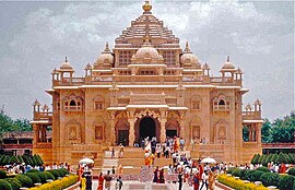
Clockwise, from top: Akshardham temple, Gandhinagar Capital Railway Station Overview, Gujarat science city, Mahatma Mandir | ||||||
| ||||||
| ഫലകം:Maplink/styles-multi.css താളിൽ ഉള്ളടക്കം ഒന്നുമില്ല. | ||||||
| Country | ||||||
| State | Gujarat | |||||
| District | Gandhinagar | |||||
| നാമഹേതു | Mahatma Gandhi | |||||
| • ഭരണസമിതി | Gandhinagar Municipal Corporation | |||||
| • Municipal Commissioner | Ratankanvar H. Gadhavicharan | |||||
| • Mayor | Rita Patel | |||||
| • ആകെ | 326 ച.കി.മീ.(126 ച മൈ) | |||||
| ഉയരം | 81 മീ(266 അടി) | |||||
(2011)[2] | ||||||
| • ആകെ | 2,92,167 | |||||
| • ജനസാന്ദ്രത | 900/ച.കി.മീ.(2,300/ച മൈ) | |||||
| • Official | Gujarati, Hindi, and English | |||||
| സമയമേഖല | UTC+5:30 (IST) | |||||
| PIN CODE | 382010[3] | |||||
| Telephone code | 079[4] | |||||
| വാഹന റെജിസ്ട്രേഷൻ | GJ-18 | |||||
| വെബ്സൈറ്റ് | gujaratindia | |||||
ചരിത്രം
തിരുത്തുക1960-ൽ ബോംബെ സംസ്ഥാനം, ഭാഷാടിസ്ഥാനത്തിൽ, മഹാരാഷ്ട്ര, ഗുജറാത്ത് എന്നീ രണ്ടു സംസ്ഥാനങ്ങളായി വിഭജിക്കപ്പെട്ടു. അഹമ്മദാബാദ് അപ്രന്റീസുകളായിരുന്ന ഇന്ത്യൻ ആർക്കിടെക്റ്റുമാറായ എച്ച്. കെ. മെവാഡ, പ്രകാശ്. എം. ആപ്തേ എന്നിവർക്കാണ് നിർമ്മാണച്ചുമതല ലഭിച്ചത്. മഹാത്മാ ഗാന്ധിയോടുള്ള ആദരസൂചകമായാണ് പുതിയ നഗരത്തിനു ഗാന്ധിനഗർ എന്നു നാമകരണം ചെയ്യപ്പെട്ടത്. സബർമതി നദീതീരത്തായി 42.9 ചതുരശ്ര കിലോമീറ്റർ വിസ്തൃതിയിലായാണ് നഗരം ആസൂത്രണം ചെയ്യപ്പെട്ടത്.
അവലംബം
തിരുത്തുക- ↑ "Municipal Expansions". The Times of India.
- ↑ "Gujarat (India): Cities and Towns in Districts - Population Statistics, Charts and Map". www.citypopulation.de.
- ↑ "PIN Code: Gandhinagar, Gujarat, India". findpincode.net.
- ↑ "Change in Ahmedabad, Gandhinagar phone numbers - Times of India". The Times of India. Retrieved 2018-03-03.


