അഗുൽഹാസ് ദേശീയോദ്യാനം
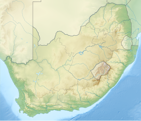
അഗുൽഹാസ് ദേശീയോദ്യാനം, കേപ് ടൗണിന് 200 കിലോമീറ്റർ (120 മൈൽ) തെക്ക്-കിഴക്കായി പടിഞ്ഞാറൻ മുനമ്പിലെ തെക്കൻ ഓവർബർഗ് മേഖലയിലെ അഗൽഹാസ് സമതലത്തിൽ സ്ഥിതിചെയ്യുന്ന ഒരു ദക്ഷിണാഫ്രിക്കൻ ദേശീയോദ്യാനമാണ്.
| Agulhas National Park | |
|---|---|
ഐ.യു.സി.എൻ. ഗണം II (ദേശീയോദ്യാനം) | |
 The Cape Agulhas lighthouse | |
| Location | Western Cape, South Africa |
| Nearest city | Struisbaai |
| Coordinates | 34°50′S 20°00′E / 34.833°S 20.000°E |
| Area | 20,959 ഹെക്ടർ (51,790 ഏക്കർ) |
| Established | 14 September 1998 |
| Governing body | South African National Parks |
| www | |
ഗാൻസ്ബായ്, സ്ട്രൂയിസ്ബായ് എന്നീ നഗരങ്ങൾക്കിടയിലെ തീരദേശ മേഖലയിൽ ഈ പാർക്ക് നിലകൊള്ളുന്നു. കേപ്പ് അഗുൽഹാസിൽ ആഫ്രിക്കയുടെ തെക്കേ മുനമ്പുവരെ ഈ ദേശീയോദ്യാനത്തിൽ ഉൾപ്പെടുന്നു. 2009 ജനുവരിയിൽ ഈ ദേശീയോദ്യാനത്തന്റെ ആകെ വിസ്തീർണ്ണം 20,959 ഹെക്ടർ (51,790 ഏക്കർ) ആണ്.[1]
ഈ ദേശീയോദ്യാനത്തിൻറെ പ്രധാന ടൂറിസ്റ്റ് ആകർഷണങ്ങൾ ആഫ്രിക്കയുടെ തെക്കേ അറ്റമായ കേപ്പ് അഗുൽഹാസും അറ്റ്ലാൻറിക്, ഇന്ത്യൻ മഹാസമുദ്രങ്ങളുടെ ഔദ്യോഗിക സംഗമസ്ഥാനവുമാണ്. അടുത്തുതന്നെ ദക്ഷിണാഫ്രിക്കയിലെ ഏറ്റവും പഴക്കമുള്ള രണ്ടാമത്തെ ലൈറ്റ് ഹൌസ് നിലകൊള്ളുന്നു. ഇത് ചെറിയൊരു മ്യൂസിയവും ചായക്കടയും ഉൾപ്പെട്ടതാണ്.
അവലംബം
തിരുത്തുക- ↑ "Agulhas National Park: Park Management Plan 2009 – 2013" (PDF). South African National Parks. 24 February 2009. p. 9. Retrieved 13 February 2010.
