മൊക
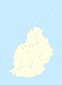
മൗറീഷ്യസിലെ മൊക ജില്ലയിലെ ഒരു ഗ്രാമമാണ് മൊക (Moka). ഗ്രാമത്തിന്റെ സിംഹഭാഗവും മൊക ജില്ലയിൽത്തന്നെയാണെങ്കിലും പടിഞ്ഞാറുഭാഗത്തെ ചെറിയൊരംശം പ്ലെയിൻസ് വിലംസ് ജില്ലയിൽ സ്ഥിതി ചെയ്യുന്നു..[4]മൊക ജില്ലാ ഭരണസമിതിയുടെ കീഴിലുള്ള മൊക ഗ്രാമസഭയാണ് (Moka Village Council) ഭരണം നടത്തുന്നത്. [5]2011ലെ കണക്കെടുപ്പിൽ ജനസംഖ്യ 8846 ആയിരുന്നു. [3]ഉന്നതി (elevation) 203 മുതൽ 425 വരെയാണ്.
മൊക | |
|---|---|
ഗ്രാമം | |
| Coordinates: 20°13′08″S 57°29′46″E / 20.219°S 57.496°E | |
| രാജ്യം | മൗറീഷ്യസ് |
| ജില്ലകൾ | മൊക ജില്ല |
| ഉയരം | 203 മീ(666 അടി) |
| ഉയരത്തിലുള്ള സ്ഥലം | 425 മീ(1,394 അടി) |
(2011 ഒക്ടോബർ)[3] | |
| • ആകെ | 8,846 |
| • ജനസാന്ദ്രത | 507.2/ച.കി.മീ.(1,314/ച മൈ) |
| സമയമേഖല | UTC+4 (Mauritius Time) |
| ഏരിയ കോഡ് | 230 |
| ISO കോഡ് | MU |
| കാലാവസ്ഥ | Am |
കുറിപ്പുകൾ
തിരുത്തുക- ↑ "Quick info, Local Time in Moka, Moka, Mauritius". Chinchi.com. Archived from the original on 2016-03-04. Retrieved 2017-07-31.
- ↑ "What is the elevation of Moka, Mauritius?". WolframAlpha.[പ്രവർത്തിക്കാത്ത കണ്ണി]
- ↑ 3.0 3.1 "Table G1 - Resident population by geographical location, whereabouts on census night and sex" (PDF). Central Statistic Office. 2011: 3. Retrieved 2012-11-29.
{{cite journal}}: Cite journal requires|journal=(help) - ↑ Statistics Mauritius (2011). "Housing and population Census 2011" (PDF). Government of Mauritius. Archived from the original (PDF) on 2013-10-21. Retrieved 28 November 2012.
{{cite journal}}: Cite journal requires|journal=(help) - ↑ Ministry of Local Government and Outer Islands. "Local Government Act 2011" (PDF). Government of Mauritius. Retrieved 28 November 2012.
{{cite journal}}: Cite journal requires|journal=(help)
