ബ്രസീലിലെ ലോക പൈതൃക സ്ഥലങ്ങൾ
ഈ താളിലെ ചില ഭാഗങ്ങൾ മലയാളത്തിലല്ല എഴുതിയിരിക്കുന്നത്. ഇതു മലയാളത്തിലേക്ക് മാറ്റിയെഴുതാൻ സഹായിക്കുക ![]()
* Trans-border site
| സൈറ്റ് | ചിത്രം | സ്ഥാനം | മാനദണ്ഡം | Area | വർഷം | വിവരണം |
|---|---|---|---|---|---|---|
| അറ്റ്ലാൻറിക് ഫോറസ്റ്റ് സൌത്ത്-ഈസ്റ്റ് റിസർവ്വ് | 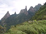
|
Paraná and São Paulo | Natural:
(vii)(ix)(x) |
468,193 (1,156,930) | 1999 | അറ്റ്ലാന്റിക് വനവിഭാഗത്തിലെ അവശേഷിക്കുന്ന വനങ്ങളിൽ ചിലത്. വളരെ അത്യപൂർവ്വവും വംശനാശഭീഷണി നേരിടുന്നതുമായ നിരവധി ജീവജാലങ്ങൾ ഇവിടെ നിലനിൽക്കുന്നു. അതിനാൽ ശാസ്ത്രജ്ഞൻമാർക്ക് ഇതിൻറെ സംരക്ഷണത്തിന് ഉയർന്ന താത്പര്യമുണ്ട്.[1] |
| ബ്രസീലിയ | 
|
Federal District15°47′00″S 47°54′00″W / 15.78333°S 47.90000°W | Cultural:
(i)(iv) |
— | 1987 | 1956 ൽ ലുസിയോ കോസ്റ്റ, ഓസ്കർ നൈമയർ എന്നിവരാണ് ബ്രസീലിയ ആസൂത്രണം ചെയ്യുകയും വികസിപ്പിക്കുകയും ചെയ്തത്. റിയോ ഡി ജനീറോയിൽ നിന്നും കൂടുതൽ കേന്ദ്ര സ്ഥാനത്തേക്ക് മാറ്റാൻ ബ്രസീലിയ മുൻ സൃഷ്ടിക്കപ്പെട്ടു. ഇന്ത്യയിലെ ചണ്ഡീഗഢിനോടൊപ്പം കോർബ്യൂസിയർ എന്ന സ്വിസ്-ഫ്രഞ്ച് വാസ്തുശിൽപി നഗരവത്കരണത്തിന്റെ അടിസ്ഥാന തത്ത്വങ്ങൾ ഇവിടെ വലിയ അളവിൽ പ്രയോഗിച്ചിട്ടുണ്ട്..[2] |
| ബ്രസീലിയൻ അറ്റ്ലാൻറിക് എെലൻറ്സ് : Fernando de Noronha and Atol das Rocas Reserves | 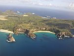
|
Pernambuco and Rio Grande do Norte | Natural:
(vii)(ix)(x) |
42,270 (104,500) | 2001 | തെക്കൻ അറ്റ്ലാന്റിക് പ്രദേശത്തെ ഏതാനും ഒറ്റപ്പെട്ട ആവാസസ്ഥലങ്ങളിൽ ഒന്നായ ഇത്, വംശനാശ ഭീഷണി നേരിടുന്ന സമുദ്രജീവികളുടെ ആഹാരമേഖല, പുനരുൽപ്പാദനസ്ഥലം പ്രത്യേകിച്ച് ഹോക്സ് ബിൽ കടലാമ) എന്ന നിലകളിൽ പ്രാധാന്യമുള്ളതാണ്.[3] |
| സെൻട്രൽആമസോൺ കൺസർവേഷൻ കോംപ്ലക്സ് | 
|
Amazonas2°20′00″S 62°00′30″W / 2.33333°S 62.00833°W | Natural:
(ix)(x) |
5,323,018 (13,153,460) | 2000[nb 1] | ആമസോൺ തടത്തിലെ ഏറ്റവും വലിയ സംരക്ഷിത പ്രദേശമെന്നതാണ് ഈ സൈറ്റിന്റെ സ്ഥാനം, ജൈവ വൈവിധ്യത്തിന് ശ്രദ്ധേയമാണ്. várzea, igapó വനങ്ങൾക്കും, വംശനാശ ഭീഷണി നേരിടുന്ന അനവധി ജീവികളുടെ സ്വാഭാവിക ആവാസകേന്ദ്രവുമാണിത്. വിവിധ സംരക്ഷണ ഏജൻസികൾ ഉയർന്ന മുൻഗണനാ മേഖലയായി ഇതിനെ അംഗീകരിച്ചിട്ടുണ്ട്.[nb 2][4][5] |
| സെറാഡോ പ്രൊട്ടക്റ്റഡ് ഏരിയാസ്: ചപ്പാഡ ഡോസ് വിയാഡെയ്റോസ് & ഇമാസ് ദേശീയോദ്യാനം | 
|
Goiás14°00′20″S 47°41′05″W / 14.00556°S 47.68472°W | Natural:
(ix)(x) |
367,356 (907,760) | 2001 | രണ്ട് ഉദ്യാനങ്ങൾ ചേർന്നതാണ് സെറാഡോ. ലോകത്തിലെ ഏറ്റവും പഴക്കമുള്ള ഉഷ്ണമേഖല ആവാസവ്യവസ്ഥയും, കാലാവസ്ഥാ വ്യതിയാനത്തിൻറെ കാലഘട്ടത്തിൽ ജീവിവർഗങ്ങളുടെ പ്രധാന രക്ഷാസങ്കേതവുമായിരുന്നു സെറാഡോ..[6] |
| ഡിസ്കവറി കോസ്റ്റ് അറ്റ്ലാൻറിക് ഫോറസ്റ്റ് റിസർവ്വ് | 
|
Bahia and Espírito Santo | Natural:
(ix)(x) |
111,930 (276,600) | 1999 | അറ്റ്ലാന്റിക് വനവിഭാഗത്തിലെ അവശേഷിക്കുന്ന വനങ്ങളിൽ ചിലത്. വളരെ അത്യപൂർവ്വവും വംശനാശഭീഷണി നേരിടുന്നതുമായ നിരവധി ജീവജാലങ്ങൾ ഇവിടെ നിലനിൽക്കുന്നു. അതിനാൽ ശാസ്ത്രജ്ഞൻമാർക്ക് ഇതിൻറെ സംരക്ഷണത്തിന് ഉയർന്ന താത്പര്യമുണ്ട്.[7] |
| ഹിസ്റ്റോറിക് സെൻറര് ഓഫ് സാൽവഡോർ ഡി ബാഹിയ | 
|
Bahia12°58′00″S 38°30′00″W / 12.96667°S 38.50000°W | Cultural:
(iv)(vi) |
— | 1985 | പുരാതന കൊളോണിയൽ പട്ടണവും ആദ്യ ബ്രസീൽ തലസ്ഥാന നഗരിയും, പുതിയ ലോകത്തിലെ ആദ്യത്തെ അടിമ വിപണിയുമായിരുന്ന പട്ടണമാണിത്. 16 മുതൽ 18 വരെ നൂറ്റാണ്ടുകളിലെ കുമ്മായച്ചാന്തുകൊണ്ടുള്ള അലങ്കാരങ്ങളോടുകൂടിയതും ബഹുവർണ്ണ നിറമുള്ളതുമായ നവോത്ഥാനകാല വീടുകൾ ഇവിടെ സംരക്ഷിച്ചുവരുന്നു.[8] |
| ഹിസ്റ്റോറിക് സെൻറർ ഓഫ് സാവോ ലൂയിസ് | 
|
Maranhão2°30′51″S 44°18′09″W / 2.51417°S 44.30250°W | Cultural:
(iii)(iv)(v) |
67 (170) | 1997 | പൂർണ്ണമായും ദീർഘചതുരാകൃതിയിലുള്ള ഒരു നഗര പദ്ധതിയും ചരിത്രപ്രധാന്യമുള്ള കെട്ടിടങ്ങളും സാവൊ ലൂയിസിൽ സംരക്ഷിച്ചിരിക്കുന്നു. പോർച്ചുഗീസ് കൊളോണിയൽ നഗരത്തിന്റെ ഉത്തമോദാഹരണമാണ് ഇത്.[9] |
| ഹിസ്റ്റോറിക് സെൻറർ ഓഫ് ദ ടൌൺ ഓഫ് ഡയമണ്ടിന | 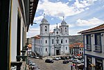
|
Minas Gerais18°40′00″S 43°36′00″W / 18.66667°S 43.60000°W | Cultural:
(ii)(iv) |
29 (72) | 1999 | 18- ആം നൂറ്റാണ്ടിലെ കൊളോണിയൽ പട്ടണത്തിലെ ബരോക് വാസ്തുവിദ്യയുടെ ഉത്തമ സംരക്ഷിത മാതൃകയായ ഇത് റോക്കി മലനിരകളിലെ ആവാസയോഗ്യമല്ലാത്ത പരിതഃസ്ഥിതിയിലാണ് പണികഴിപ്പിക്കപ്പെട്ടത്. 18, 19 നൂറ്റാണ്ടുകളിൽ വജ്ര ഖനന കേന്ദ്രമായിരുന്നു.[10] |
| ഹിസ്റ്റോറിക് സെൻറർ ഓഫ് ദ ടൌൺ ഓഫ് ഗോയിയാസ് | 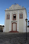
|
Goiás15°56′00″S 50°08′00″W / 15.93333°S 50.13333°W | Cultural:
(ii)(iv) |
40 (99) | 2001 | 1727-ൽ bandeirante (17 ആം നൂറ്റാണ്ടിലെ ബ്രസീലിലെ പോർച്ചുഗീസ് കുടിയേറ്റക്കാരും നിധി വേട്ടക്കാരും) പര്യവേക്ഷകനായിരുന്ന ബർത്തലോമ്യോ ബ്യൂണോ ഡ സിൽവ സ്ഥാപിച്ച ഗോയിയാസ് അതിന്റെ കൊളോണിയൽ പാരമ്പര്യം സംരക്ഷിച്ചു നിലനിർത്തിയിരിക്കുന്നു. അതുപോലെതന്നെ തെക്കേ അമേരിക്കയുടെ ഉൾപ്രദേശത്തെ യൂറോപ്യൻ കുടിയേറ്റത്തിന്റെ ഉത്തമ മാതൃകയുമാണ് ഗോയിയാസ്.[11] |
| ഹിസ്റ്റോറിക് സെൻറർ ഓഫ് ദ ടൌണ് ഓഫ് ഒലിൻഡ | 
|
Pernambuco8°00′48″S 34°50′42″W / 8.01333°S 34.84500°W | Cultural:
(ii)(iv) |
120 (300) | 1982 | 1537-ൽ സ്ഥാപിതമായ ഈ നഗരം കരിമ്പു കൃഷിയിലൂടെയും പഞ്ചസാരയുടെ ഉല്പാദനകേന്ദ്രമായുമാണ് വളർന്നത്. പതിനേഴാം നൂറ്റാണ്ടിലെ ഡച്ചുകാരാൽ കൊള്ളയടിക്കപ്പെട്ടിരുന്നു. 18 ആം നൂറ്റാണ്ടിലെ ഈ ചരിത്രകേന്ദ്രത്തിൽ അനേകം കെട്ടിടങ്ങളും ദേവാലയങ്ങളും ഉദ്യാനങ്ങളും കോൺവെൻറുകളും അനുജോജ്യമായ സങ്കലനത്തിൽ നിലനിൽക്കുന്നു.[12] |
| ഹിസ്റ്റോറിക് ടൌൺ ഓഫ് ഔറോ പെട്രോ | 
|
Minas Gerais20°23′20″S 43°30′20″W / 20.38889°S 43.50556°W | Cultural:
(i)(iii) |
— | 1980 | 18-ആം നൂറ്റാണ്ടിൽ ബ്രസീലിയൻ സ്വർണവേട്ടയുടെ കേന്ദ്രമെന്ന നിലയിലാണ് ഈ നഗരം അഭിവൃദ്ധി പ്രാപിച്ചത്. സംരക്ഷിതമായ നിരവധി ദേവാലയങ്ങൾ, പാലങ്ങൾ, ജലധാരകൾ എന്നിവ ഇവിടെ നിലനിൽക്കുന്നു. അവയിൽ പലതും ബറോഖ് ശിൽപ്പിയായ അലീജാദിൻഹോ രൂപകല്പന ചെയ്തതാണ്.[13] |
| ഇഗ്വാക്കു ദേശീയോദ്യാനം | 
|
Paraná25°41′00″S 54°26′00″W / 25.68333°S 54.43333°W | Natural:
(vii)(x) |
170,086 (420,290) | 1986 | Together with Iguazú National Park on the Argentinian side, the park protects Iguazu Falls, one of the world's largest waterfalls, and is home to many rare and endangered species such as giant anteater or the giant otter. The site had been listed as endangered 1999–2001 due to an illegally opened road through the park, dams on the Iguazu River and helicopter flights.[14] |
| ജെസ്യൂട്ട് മിഷൻസ് ഓഫ് ദ ഗ്വാരാനിസ്: San Ignacio Miní, Santa Ana, Nuestra Señora de Loreto and Santa María Mayor (Argentina), Ruins of São Miguel das Missões (Brazil) | 
|
Rio Grande do Sulalso Misiones Province, Argentina | Cultural:
(iv) |
— | 1983[nb 3] | 17 ഉം 18 ഉം നൂറ്റാണ്ടുകളിൽ, ഉഷ്ണമേഖലാ വനത്തിനുള്ളിലായി ഗ്വാരാനി ജനങ്ങളുടെ ഭൂമിയിൽ ഒരു പ്രത്യേക ഡിസൈനിൽ നിർമ്മിക്കപ്പെട്ടതും പിന്നീട് നശിച്ചുപോയതുമായ 5 സ്പാനിഷ് ജെസ്യൂട്ട് മിഷനുകളാണ് ഇവിടെയുള്ളത്.[15][16] |
| Pampulha Modern Ensemble | 
|
Minas Gerais19°51′07″S 43°58′25″W / 19.85194°S 43.97361°W | Cultural:
(i)(ii)(iv) |
154 (380) | 2016 | The listed site consists of an urban project created in 1940 at Belo Horizonte, Minas Gerais. It was designed around an artificial lake, Lake Pampulha, and includes a casino, a ballroom, the Golf Yacht Club and the Church of Saint Francis of Assisi. The buildings were designed by the architect Oscar Niemeyer, in collaboration with the landscape architect Roberto Burle Marx and Brazilian Modernist artists.[17] |
| പാൻറനാൽ കൺസർവേഷൻ ഏരിയ | 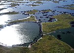
|
Mato Grosso and Mato Grosso do Sul | Natural:
(vii)(ix)(x) |
187,818 (464,110) | 2000 | ഈ സൈറ്റിൽ നാല് സംരക്ഷിത മേഖലകളുണ്ട്, ലോകത്തിലെ ഏറ്റവും വലിയ ശുദ്ധജല ഈർപ്പനിലമുള്ള ജൈവവ്യവസ്ഥയുള്ളതും വൈവിധ്യമാർന്ന ഒട്ടനവധി ജീവിയിനങ്ങളുടെ സ്വാഭാവിക ആവാസവ്യവസ്ഥയുമായുമാണിത്.[18] |
| Rio de Janeiro: Carioca Landscapes Between the Mountain and the Sea | 
|
Rio de Janeiro22°56′52″S 43°17′29″W / 22.94778°S 43.29139°W | Cultural:
(v)(vi) |
7,249 (17,910) | 2012 | The listed site consists of an exceptional urban setting rather than built heritage. It encompasses the key natural elements that have shaped and inspired the development of the city: from the highest points of the Tijuca National Park’s mountains down to the sea. They also include the Botanical Gardens, established in 1808, Corcovado Mountain with its celebrated statue of Christ and the hills around Guanabara Bay, including the extensive designed landscapes along Copacabana Bay which have contributed to the outdoor living culture of this spectacular city. Rio de Janeiro is also recognized for the artistic inspiration it has provided to musicians, landscapers and urbanists.[19] |
| Sanctuary of Bom Jesus do Congonhas | 
|
Minas Gerais20°29′59″S 43°51′28″W / 20.49972°S 43.85778°W | Cultural:
(i)(iv) |
— | 1985 | പതിനെട്ടാം നൂറ്റാണ്ടിൽ നിർമ്മിച്ച ഒരു പള്ളി, തുറസായ സ്ഥലത്തുള്ള ഒരു പടിക്കെട്ട്, അലൈജാദിൻഹോ എന്ന ബ്രസീലിയൻ ശില്പി നിർമ്മിച്ച, പ്രതിമകളാൽ അലംകൃതമായ ഏഴ് ചാപ്പലുകൾ എന്നിവയാണ് ഈ സൈറ്റിലുള്ളത്.[20] |
| São Francisco Square in the Town of São Cristóvão | 
|
Sergipe11°00′58″S 37°12′36″W / 11.01611°S 37.21000°W | Cultural:
(ii)(iv) |
3 (7.4) | 2010 | രണ്ട് പള്ളികൾ, ഒരു കൊട്ടാരം, വിവിധ ചരിത്ര കാലഘട്ടങ്ങളിലെ മറ്റു കെട്ടിടങ്ങൾ എന്നിവ ഈ ചത്വരത്തിനു ചുറ്റിലുമുണ്ട്. വടക്കുകിഴക്കൻ ബ്രസീലിലെ ഫ്രാൻസിസ്കൻ വാസ്തുവിദ്യയെ ഈ കെട്ടിടങ്ങൾ എടുത്തുകാണിക്കുന്നു.[21] |
| സെറ ഡ കപിവാര ദേശീയോദ്യാനം | 
|
Piauí8°25′00″S 42°20′00″W / 8.41667°S 42.33333°W | Cultural:
(iii) |
— | 1991 | സൗത്ത് അമേരിക്കയിലെ ഏറ്റവും പഴക്കം ചെന്ന മനുഷ്യ സമൂഹത്തിൻറെ അധിവാസകേന്ദ്രമായിരുന്നുവെെന്നു വിശ്വസിക്കപ്പെടുന്ന ഈ സ്ഥലത്ത്, ധാരാളം ഗുഹാ ചിത്രങ്ങൾ ഉണ്ട്. ഇവയിൽ മിക്കവയും 25,000 വർഷങ്ങൾക്ക് മുമ്പുള്ളതാണെന്നു കരുതപ്പെടുന്നു..[22] |
അവലംബം
തിരുത്തുക
- ↑ Extended in 2003 to include the Amana Sustainable Development Reserve, the Demonstration area of the Mamirauá Sustainable Development Reserve and the Anavilhanas Ecological Station; and name change from Jaú National Park, Brazil to the present name.
- ↑ It is a Centre of Plant Diversity, an Endemic Bird Area of the World and a Global 200 ecoregion.
- ↑ Extended in 1984 to include the four Argentinian missions making it a trans-border site; and name change from The Ruins of São Miguel das Missões to the present name.
- ↑ "Atlantic Forest South-East Reserves". UNESCO. Retrieved 28 May 2010.
- ↑ "Brasília". UNESCO. Retrieved 28 May 2010.
- ↑ "Brazilian Atlantic Islands: Fernando de Noronha and Atol das Rocas Reserves". UNESCO. Retrieved 28 May 2010.
- ↑ "Central Amazon Conservation Complex". UNESCO. Retrieved 28 May 2010.
- ↑ "Decision - 27COM 8C.10 - Central Amazon Conservation Complex (Brazil)". UNESCO. Retrieved 26 September 2011.
- ↑ "Cerrado Protected Areas: Chapada dos Veadeiros and Emas National Parks". UNESCO. Retrieved 28 May 2010.
- ↑ "Discovery Coast Atlantic Forest Reserves". UNESCO. Retrieved 28 May 2010.
- ↑ "Historic Centre of Salvador de Bahia". UNESCO. Retrieved 28 May 2010.
- ↑ "Historic Centre of São Luís". UNESCO. Retrieved 28 May 2010.
- ↑ "Historic Centre of the Town of Diamantina". UNESCO. Retrieved 28 May 2010.
- ↑ "Historic Centre of the Town of Goiás". UNESCO. Retrieved 10 September 2011.
- ↑ "Historic Centre of the Town of Olinda". UNESCO. Retrieved 10 September 2011.
- ↑ "Historic Town of Ouro Preto". UNESCO. Retrieved 10 September 2011.
- ↑ "Iguaçu National Park". UNESCO. Retrieved 10 September 2011.
- ↑ "Jesuit Missions of the Guaranis: San Ignacio Mini, Santa Ana, Nuestra Señora de Loreto and Santa Maria Mayor (Argentina), Ruins of Sao Miguel das Missoes (Brazil)". UNESCO. Retrieved 8 September 2011.
- ↑ "Jesuit Missions of the Guaranis". UNESCO. Retrieved 8 September 2011.
- ↑ "Pampulha Modern Ensemble". UNESCO. Retrieved 17 July 2016.
- ↑ "Pantanal Conservation Area". UNESCO. Retrieved 13 August 2016.
- ↑ "Rio de Janeiro: Carioca Landscapes between the Mountain and the Sea". UNESCO. Retrieved 2 July 2011.
- ↑ "Sanctuary of Bom Jesus do Congonhas". UNESCO. Retrieved 13 August 2016.
- ↑ "São Francisco Square in the Town of São Cristóvão". UNESCO. Retrieved 13 August 2016.
- ↑ "Serra da Capivara National Park". UNESCO. Retrieved 13 August 2016.