പ്രമാണം:Zealandia, topographic map.jpg

ഈ പ്രിവ്യൂവിന്റെ വലിപ്പം: 529 × 600 പിക്സലുകൾ. മറ്റ് റെസലൂഷനുകൾ: 212 × 240 പിക്സലുകൾ | 423 × 480 പിക്സലുകൾ | 678 × 768 പിക്സലുകൾ | 903 × 1,024 പിക്സലുകൾ | 1,500 × 1,700 പിക്സലുകൾ.
പൂർണ്ണ വലിപ്പം (1,500 × 1,700 പിക്സൽ, പ്രമാണത്തിന്റെ വലിപ്പം: 4.57 എം.ബി., മൈം തരം: image/jpeg)
| ഈ പ്രമാണം വിക്കിമീഡിയ കോമൺസിൽ നിന്നുള്ളതാണ്. പ്രമാണത്തെക്കുറിച്ചുള്ള വിവരണം താഴെ കൊടുത്തിരിക്കുന്നു.
|
ചുരുക്കം
| വിവരണം |
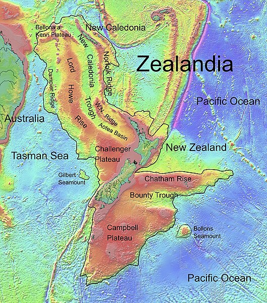
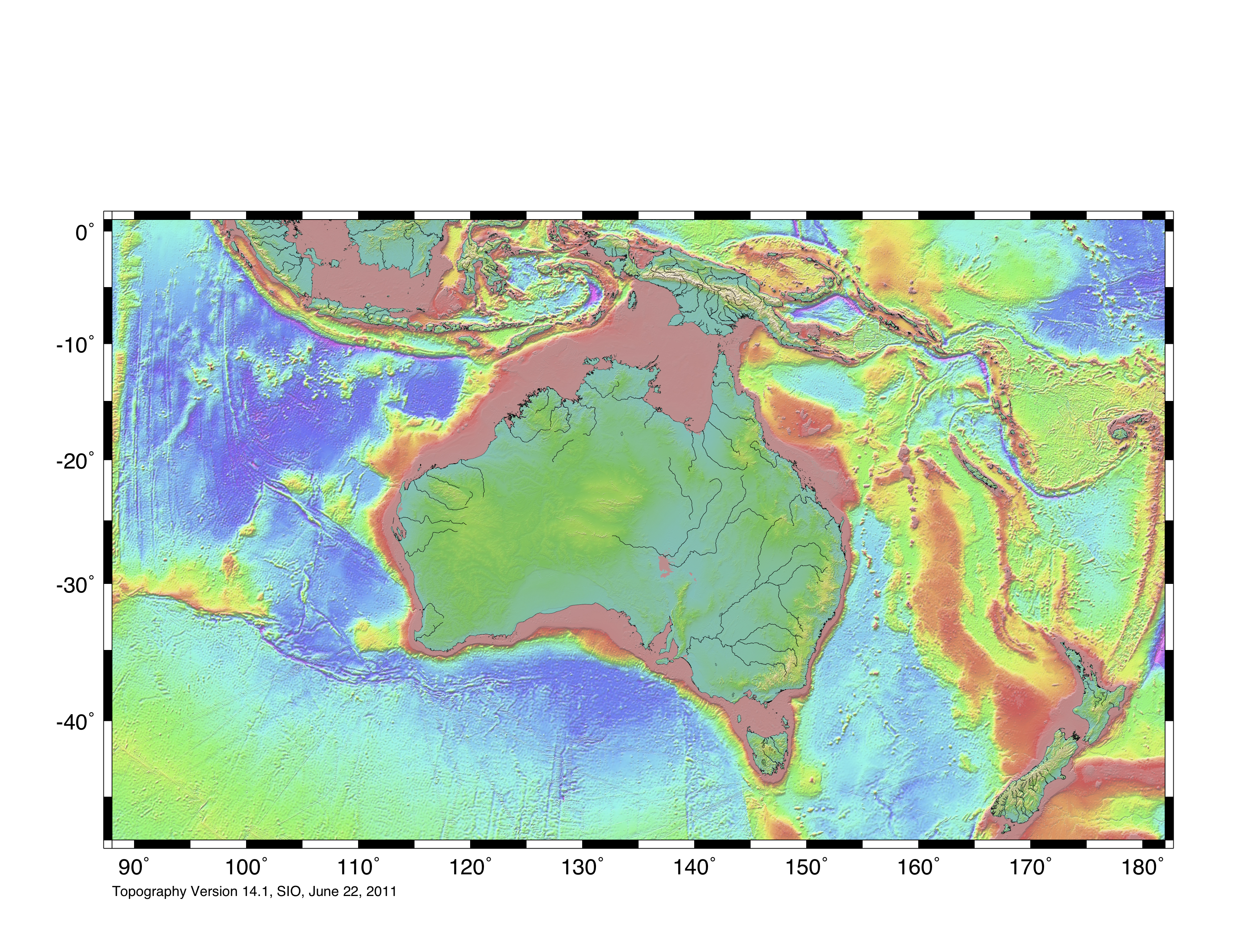
Deutsch: Die topografische Karte von Zealandia basiert auf den Bathymetrie-Daten des Scripps Institution of Oceanography, University of California, San Diego.
Die Umrandung zw. Grenzziehung basiert auf Informationen des Buches: Nick Mortimer; Hamish Campbell (2014) Zealandia - Our Continent Revealed, ലണ്ടൻ: Penguin Books, p. 54 ISBN: 978-0-143-57156-8. English: Topographic map of Zealandia, based on bathymetry data from Scripps Institution of Oceanography, University of California, San Diego.
Boundary is based on information which was given in: Nick Mortimer; Hamish Campbell (2014) Zealandia - Our Continent Revealed, ലണ്ടൻ: Penguin Books, p. 54 ISBN: 978-0-143-57156-8. Français : Carte topographique du continent de Zealandia, basée sur des données bathymétriques du Scripps Institution of Oceanography, Université de Californie, San Diego, États-Unis. La limite du continent est tirée d'informations venant de : « Nick Mortimer; Hamish Campbell (2014) Zealandia - Our Continent Revealed, Londres: Penguin Books, p. 54 ISBN: 978-0-143-57156-8. ». |
| തീയതി | |
| സ്രോതസ്സ് | http://topex.ucsd.edu/WWW_html/mar_topo.html; http://topex.ucsd.edu/marine_topo/jpg_images/topo10.jpg; http://topex.ucsd.edu/marine_topo/jpg_images/topo11.jpg; http://topex.ucsd.edu/marine_topo/jpg_images/topo14.jpg; http://topex.ucsd.edu/marine_topo/jpg_images/topo15.jpg |
| സ്രഷ്ടാവ് | Ulrich Lange, Bochum, Germany |
| മറ്റു പതിപ്പുകൾ |
 |
There is no copyright on published bathmetry data, (free use)
അനുമതി
ഈ സൃഷ്ടിയുടെ പകർപ്പവകാശ ഉടമയായ ഞാൻ, താഴെ പറയുന്ന അനുമതിയിൽ ഈ സൃഷ്ടി ഇതിനാൽ പ്രസിദ്ധീകരിക്കുന്നു:
| ഈ പ്രമാണം സൃഷ്ടിച്ചിരിക്കുന്നത് ക്രിയേറ്റീവ് കോമൺസ് സി.സി.0 ആഗോള പൊതുസഞ്ചയത്തിലേയ്ക്ക് സമർപ്പിച്ചിരിക്കുന്നത് ആയിട്ടാണ്. | |
| ഈ പ്രമാണത്തിന്റെ സൃഷ്ടിയുമായി ബന്ധപ്പെട്ട വ്യക്തി, പകർപ്പവകാശ നിയമവുമായി ബന്ധപ്പെട്ട എല്ലാ നിയമപരമായ അവകാശങ്ങളും, നിയമം അനുവദിക്കുന്ന പരിധി വരെ, അദ്ദേഹത്തിന്റെ/അവരുടെ എല്ലാ അവകാശങ്ങളും, അവയുമായി ബന്ധപ്പെട്ട അവകാശങ്ങളും ആഗോളവ്യാപകമായി പരിത്യജിച്ച്, തന്റെ പ്രവർത്തനം പൊതുസഞ്ചയത്തിലേയ്ക്ക് സമർപ്പിച്ചിരിക്കുന്നു. ഈ സൃഷ്ടി, വ്യാപാരോദ്ദേശമുൾപ്പെടെ ഏതൊരാവശ്യത്തിനും അനുമതിയൊന്നുമാവശ്യപ്പെടാതെ പകർത്താനും, മാറ്റം വരുത്താനും, വിതരണം ചെയ്യാനും, അവതരിപ്പിക്കാനും താങ്കൾക്ക് സാദ്ധ്യമാണ്.
|
പ്രമാണ നാൾവഴി
ഏതെങ്കിലും തീയതി/സമയ കണ്ണിയിൽ ഞെക്കിയാൽ പ്രസ്തുതസമയത്ത് ഈ പ്രമാണം എങ്ങനെയായിരുന്നു എന്നു കാണാം.
| തീയതി/സമയം | ലഘുചിത്രം | അളവുകൾ | ഉപയോക്താവ് | അഭിപ്രായം | |
|---|---|---|---|---|---|
| നിലവിലുള്ളത് | 16:55, 9 ഫെബ്രുവരി 2019 | | 1,500 × 1,700 (4.57 എം.ബി.) | Ulanwp | spelling of Bollons Seamount corrected |
| 20:43, 21 മാർച്ച് 2017 |  | 1,500 × 1,700 (4.57 എം.ബി.) | Ulanwp | Geographical Names inserted | |
| 19:59, 20 മാർച്ച് 2017 |  | 1,500 × 1,700 (4.44 എം.ബി.) | Ulanwp | {{Information |Description ={{en|1=Topographic map of Zealandia, based on bathmetry data from Scripps Institution of Oceanography, University of California, San Diego}} |Source =http://topex.ucsd.edu/WWW_html/mar_topo.html |Author =U... |
പ്രമാണത്തിന്റെ ഉപയോഗം
താഴെ കാണുന്ന താളിൽ ഈ ചിത്രം ഉപയോഗിക്കുന്നു:
പ്രമാണത്തിന്റെ ആഗോള ഉപയോഗം
താഴെ കൊടുത്തിരിക്കുന്ന മറ്റ് വിക്കികൾ ഈ പ്രമാണം ഉപയോഗിക്കുന്നു:
- ar.wikipedia.org സംരംഭത്തിലെ ഉപയോഗം
- ast.wikipedia.org സംരംഭത്തിലെ ഉപയോഗം
- bg.wikipedia.org സംരംഭത്തിലെ ഉപയോഗം
- ca.wikipedia.org സംരംഭത്തിലെ ഉപയോഗം
- ceb.wikipedia.org സംരംഭത്തിലെ ഉപയോഗം
- de.wikipedia.org സംരംഭത്തിലെ ഉപയോഗം
- Lord Howe Rise
- Zealandia
- Gisborne-Erdbeben von 2007
- Geologie Neuseelands
- Geographie Neuseelands
- Chatham Rise
- Campbell Plateau
- Bounty Trough
- Norfolk Ridge
- New Caledonia Trough
- Challenger Plateau
- Geologie der Antarktischen Halbinsel
- Geologie Ostantarktikas
- Vulkanische Provinzen der Antarktischen Halbinsel
- en.wikipedia.org സംരംഭത്തിലെ ഉപയോഗം
- Chatham Rise
- Lord Howe Rise
- South Tasman Rise
- Campbell Plateau
- Meiolania
- Challenger Plateau
- Norfolk Ridge
- Lord Howe Seamount Chain
- Continent
- Submerged continent
- East Tasman Plateau
- Bollons Seamount
- Bounty Trough
- Tasmantid Seamount Chain
- Tasmantid hotspot
- Joseph Gilbert Seamount
- Gascoyne Seamount
- Geology of New Caledonia
- Taupo Bank
- Derwent Hunter Guyot
- Britannia Guyots
- Queensland Guyot
- Geology of Zealandia
- Three Kings Ridge
- es.wikipedia.org സംരംഭത്തിലെ ഉപയോഗം
- eu.wikipedia.org സംരംഭത്തിലെ ഉപയോഗം
- fr.wikipedia.org സംരംഭത്തിലെ ഉപയോഗം
ഈ പ്രമാണത്തിന്റെ കൂടുതൽ ആഗോള ഉപയോഗം കാണുക.