പ്രമാണം:Arctic Ocean relief location map.png

ഈ പ്രിവ്യൂവിന്റെ വലിപ്പം: 600 × 600 പിക്സലുകൾ. മറ്റ് റെസലൂഷനുകൾ: 240 × 240 പിക്സലുകൾ | 480 × 480 പിക്സലുകൾ | 768 × 768 പിക്സലുകൾ | 1,181 × 1,181 പിക്സലുകൾ.
പൂർണ്ണ വലിപ്പം (1,181 × 1,181 പിക്സൽ, പ്രമാണത്തിന്റെ വലിപ്പം: 2.19 എം.ബി., മൈം തരം: image/png)
| ഈ പ്രമാണം വിക്കിമീഡിയ കോമൺസിൽ നിന്നുള്ളതാണ്. പ്രമാണത്തെക്കുറിച്ചുള്ള വിവരണം താഴെ കൊടുത്തിരിക്കുന്നു.
|
ചുരുക്കം
| വിവരണം |
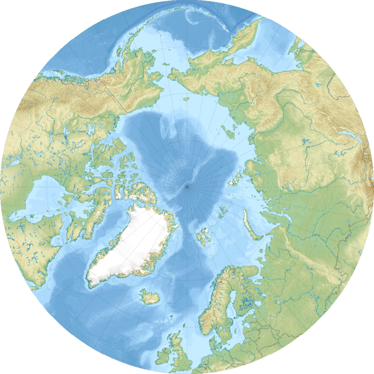
English: Relief location map of the Arctic Ocean.
|
| തീയതി | |
| സ്രോതസ്സ് | സ്വന്തം സൃഷ്ടി |
| സ്രഷ്ടാവ് | Uwe Dedering |
| മറ്റു പതിപ്പുകൾ |
|

അനുമതി
ഈ സൃഷ്ടിയുടെ പകർപ്പവകാശ ഉടമയായ ഞാൻ, താഴെ പറയുന്ന അനുമതികളിൽ ഈ സൃഷ്ടി ഇതിനാൽ പ്രസിദ്ധീകരിക്കുന്നു:
ഈ പ്രമാണത്തിന് അനുമതി നൽകപ്പെട്ടിരിക്കുന്നത് ക്രിയേറ്റീവ് കോമൺസ് ആട്രിബ്യൂഷൻ-ഷെയർ എലൈക് 3.0 അൺപോർട്ടഡ് അനുവാദപത്ര പ്രകാരമാണ്.
- താങ്കൾക്കുള്ള സ്വാതന്ത്ര്യങ്ങൾ:
- പങ്ക് വെയ്ക്കൽ – കൃതി പകർത്താനും, വിതരണം ചെയ്യാനും, പ്രസരിപ്പിക്കാനും
- പുനഃമിശ്രണം ചെയ്യൽ – കൃതി അനുയുക്തമാക്കാൻ
- താഴെ പറയുന്ന ഉപാധികൾ പാലിക്കുക:
- കടപ്പാട് – രചയിതാവോ അനുമതിയുള്ളയാളോ വ്യക്തമാക്കിയിട്ടുള്ള വിധത്തിൽ കൃതിയ്ക്കുള്ള കടപ്പാട് താങ്കൾ നൽകിയിരിക്കണം. താങ്കൾക്കിത് ഏത് വിധത്തിൽ വേണമെങ്കിലും ചെയ്യാവുന്നതാണ്, പക്ഷേ അത് അവർ താങ്കളേയോ താങ്കളുടെ ഉപയോഗത്തേയോ അടിച്ചേൽപ്പിച്ചതു പോലെയാവരുത്.
- ഇതു പോലെ പങ്ക് വെയ്ക്കുക – ഈ സൃഷ്ടിയെ പുനഃമിശ്രണം ചെയ്തോ രൂപാന്തരപ്പെടുത്തിയോ അടിസ്ഥാനപ്പെടുത്തിയോ ഉണ്ടാക്കുന്നവ; താങ്കളുടെ സംഭാവനയടക്കമുള്ള സൃഷ്ടി യഥാർത്ഥ സൃഷ്ടിയുടെ അതേ അല്ലെങ്കിൽ അനുരൂപമായ ഉപയോഗാനുമതിയിൽ മാത്രമേ താങ്കൾ വിതരണം ചെയ്യാവൂ.

|
സ്വതന്ത്ര സോഫ്റ്റ്വേർ സമിതി പ്രസിദ്ധീകരിച്ചിട്ടുള്ള ഗ്നു സ്വതന്ത്ര പ്രമാണ അനുവാദപത്രം പതിപ്പ് 1.2 അല്ലെങ്കിൽ പുതിയ പതിപ്പുകൾ പ്രകാരം; മാറ്റമില്ലാത്ത ഭാഗങ്ങളില്ലാതെ, മുൻചട്ടയിലെ എഴുത്തുകൾ ഇല്ലാതെ, പിൻചട്ടയിലെ എഴുത്തുകൾ ഇല്ലാതെ പകർത്താനും, വിതരണം ചെയ്യാനും ഒപ്പം/അല്ലെങ്കിൽ ഈ പ്രമാണത്തിൽ മാറ്റം വരുത്തുവാനും ഉള്ള അവകാശങ്ങൾ നൽകുന്നു. ഗ്നു സ്വതന്ത്ര പ്രമാണ അനുവാദപത്രം എന്ന തലക്കെട്ടിൽ അനുവാദപത്രത്തിന്റെ ഒരു പകർപ്പ് ഉൾപ്പെടുത്തിയിട്ടുണ്ട്. |
താങ്കൾക്ക് താങ്കളുടെ ഇച്ഛാനുസരണം അനുമതി തിരഞ്ഞെടുക്കാം.
പ്രമാണ നാൾവഴി
ഏതെങ്കിലും തീയതി/സമയ കണ്ണിയിൽ ഞെക്കിയാൽ പ്രസ്തുതസമയത്ത് ഈ പ്രമാണം എങ്ങനെയായിരുന്നു എന്നു കാണാം.
| തീയതി/സമയം | ലഘുചിത്രം | അളവുകൾ | ഉപയോക്താവ് | അഭിപ്രായം | |
|---|---|---|---|---|---|
| നിലവിലുള്ളത് | 08:49, 24 ഡിസംബർ 2010 | | 1,181 × 1,181 (2.19 എം.ബി.) | Uwe Dedering | {{Information |Description={{en|1= Relief location map of the Arctic Ocean. * Projection: Azimuthal equidistant projection. * Area of interest: :* N: 90.0° N :* S: 50.0° N :* W: -180.0° E :* E: 180.0° E * Projection center: :* NS: 90° N :* WE: 0° E |
പ്രമാണത്തിന്റെ ഉപയോഗം
താഴെ കാണുന്ന താളിൽ ഈ ചിത്രം ഉപയോഗിക്കുന്നു:
പ്രമാണത്തിന്റെ ആഗോള ഉപയോഗം
താഴെ കൊടുത്തിരിക്കുന്ന മറ്റ് വിക്കികൾ ഈ പ്രമാണം ഉപയോഗിക്കുന്നു:
- ar.wikipedia.org സംരംഭത്തിലെ ഉപയോഗം
- ast.wikipedia.org സംരംഭത്തിലെ ഉപയോഗം
- az.wikipedia.org സംരംഭത്തിലെ ഉപയോഗം
- ban.wikipedia.org സംരംഭത്തിലെ ഉപയോഗം
- be-tarask.wikipedia.org സംരംഭത്തിലെ ഉപയോഗം
- ceb.wikipedia.org സംരംഭത്തിലെ ഉപയോഗം
- ce.wikipedia.org സംരംഭത്തിലെ ഉപയോഗം
- cs.wikipedia.org സംരംഭത്തിലെ ഉപയോഗം
- de.wikipedia.org സംരംഭത്തിലെ ഉപയോഗം
- dsb.wikipedia.org സംരംഭത്തിലെ ഉപയോഗം
- en.wikipedia.org സംരംഭത്തിലെ ഉപയോഗം
- Kara Sea
- White Sea
- Ilulissat
- East Siberian Sea
- Kursk submarine disaster
- Lincoln Sea
- ATOW1996
- Jan Mayensfield
- Litke Deep
- Pechora Sea
- Molloy Deep
- Prince Gustaf Adolf Sea
- 83-42
- Module:Location map/data/Arctic/doc
- User:Dino/sandbox
- Greenland Plain
- York Mountains
- Iversenfjellet
- Keilhaufjellet
- Lake North Pole
- Hovtinden
ഈ പ്രമാണത്തിന്റെ കൂടുതൽ ആഗോള ഉപയോഗം കാണുക.