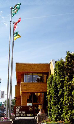
നോർത്ത് ബാറ്റിൽഫോർഡ്
നോർത്ത് ബാറ്റിൽഫോർഡ് കാനഡയിലെ പടിഞ്ഞാറൻ-മധ്യ സസ്കാച്ചെവാനിലുള്ള ഒരു നഗരമാണ്. പ്രവിശ്യയിലെ ഏഴാമത്തെ വലിയ നഗരമായ ഇത് ബാറ്റിൽഫോർഡ് പട്ടണത്തിൽ നിന്ന് വടക്കൻ സസ്കാച്ചെവൻ നദിക്ക് എതിരെ സ്ഥിതിചെയ്യുന്നു. രണ്ട് സമൂഹങ്ങളും ഒരുമിച്ച് "ബാറ്റിൽഫോർഡ്സ്" എന്നാണ് അറിയപ്പെടുന്നത്. നോർത്ത് ബാറ്റിൽഫോർഡ്, ഉൾനാടൻ മുനിസിപ്പാലിറ്റിയായ നോർത്ത് ബാറ്റിൽഫോർഡ് നമ്പർ 437, നോർത്ത് ബാറ്റിൽഫോർഡ് ക്രൗൺ കോളനി (സെൻസസ് സബ്ഡിവിഷൻ) എന്നിവയുമായി അതിർത്തി പങ്കിടുന്നു.[4]
നോർത്ത് ബാറ്റിൽഫോർഡ് | ||
|---|---|---|
| City of North Battleford | ||
 North Battleford City Hall | ||
| ||
| ലുവ പിഴവ് ഘടകം:Location_map-ൽ 522 വരിയിൽ : Unable to find the specified location map definition: "Module:Location map/data/Saskatchewan" does not exist | ||
| Coordinates: 52°45′27″N 108°17′10″W / 52.75750°N 108.28611°W | ||
| Country | Canada | |
| Province | Saskatchewan | |
| Census division | 16 | |
| Rural municipality | North Battleford | |
| Village | 1906 | |
| Town | 1907 | |
| City | 1913 | |
| • Mayor | David Gillan | |
| • MLA | Jeremy Cockrill (SKP) | |
| • MP | Rosemarie Falk (CON) | |
| • ഭൂമി | 33.55 ച.കി.മീ.(12.95 ച മൈ) | |
| • മെട്രോ | 1,122.99 ച.കി.മീ.(433.59 ച മൈ) | |
(2011)[1] | ||
| • City | 13,888 | |
| • ജനസാന്ദ്രത | 414.0/ച.കി.മീ.(1,072/ച മൈ) | |
| • മെട്രോപ്രദേശം | 19,216 | |
| • മെട്രോ സാന്ദ്രത | 17.1/ച.കി.മീ.(44/ച മൈ) | |
| സമയമേഖല | UTC−6 (CST) | |
| Forward sortation area | ||
| ഏരിയ കോഡ് | 306, 639 | |
| വെബ്സൈറ്റ് | City of North Battleford | |
| [2][3] | ||
അവലംബം
തിരുത്തുക- ↑ "2011 Community Profiles". Statistics Canada. Government of Canada. Archived from the original on 2016-10-07. Retrieved 2013-12-06.
- ↑ National Archives, Archivia Net. "Post Offices and Postmasters". Retrieved 2013-12-06.
- ↑ Government of Saskatchewan, MRD Home. "Municipal Directory System". Archived from the original on 2016-01-15. Retrieved 2013-12-06.
- ↑ "geodepot.statcan.ca". Archived from the original on 2021-01-25. Retrieved 2023-07-09.