നമാക്വാ ദേശീയോദ്യാനം
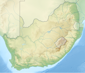
നമാക്വാ ദേശീയോദ്യനാം, കേപ്പ് ടൗണിന് 495 കിലോമീറ്റർ വടക്കും കമീസ്ക്രൂൻ പട്ടണത്തിന് 22 കിലോമീറ്റർ വടക്കു പടിഞ്ഞാറുമായി സ്ഥിതിചെയ്യുന്ന ഒരു തെക്കേ ആഫ്രിക്കൻ ദേശീയോദ്യാനമാണ്. 700 ചതുരശ്ര കിലോമീറ്ററിൽ കൂടുതൽ വിസ്തൃതിയുള്ളതാണ് ഈ ദേശീയോദ്യാനം.[1] സക്കുലെൻറ് കരൂ ബയോം എന്ന അർദ്ധ മരുപ്രദേശത്തിനുള്ളിൽ സ്ഥിതിചെയ്യുന്ന 55,000 ചതുരശ്ര കിലോമീറ്റർ വിസ്തീർണ്ണമുളള പ്രദേശമായ നമക്വാലാൻറിൻറെ ഭാഗമാണ് ഈ ദേശീയോദ്യാനം.[2][3]
| Namaqua National Park | |
|---|---|
ഐ.യു.സി.എൻ. ഗണം II (ദേശീയോദ്യാനം) | |
 Spring flowers in the N.P. | |
| Location | Northern Cape, South Africa |
| Nearest city | Kamieskroon |
| Coordinates | 30°2′36″S 17°35′10″E / 30.04333°S 17.58611°E |
| Area | 700 കി.m2 (270 ച മൈ) |
| Established | 1999 |
| Governing body | South African National Parks |
| www | |
അവലംബം
തിരുത്തുക- ↑ Van Deventer, M. and J.A.J. Nel. 2006. Habitat, food, and small mammal community structure in Namaqualand. Koedoe 49(1): 99–109. Pretoria. ISSN 0075-6458
- ↑ Van Deventer, M. and J.A.J. Nel. 2006. Habitat, food, and small mammal community structure in Namaqualand. Koedoe 49(1): 99–109. Pretoria. ISSN 0075-6458
- ↑ Martin, Vance; Andrew Muir (2004). Wilderness And Human Communities: The Spirit Of The 21st Century: Proceedings From The 7th World Wilderness Congress. Fulcrum Publishing. p. 193. ISBN 1-55591-866-2.
