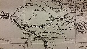
അരുവിമി നദി
ആഫ്രിക്കയിലെ നദി
കോംഗോയുടെ വടക്കും കിഴക്കും സ്ഥിതിചെയ്യുന്ന കോംഗോ നദിയുടെ പോഷക നദിയാണ് അരുവിമി നദി.[1]
| അരുവിമി നദി | |
| Ituri River | |
| River | |
| രാജ്യം | Democratic Republic of the Congo |
|---|---|
| പോഷക നദികൾ | |
| - ഇടത് | Congo River |
| സ്രോതസ്സ് | Blue Mountains |
| അഴിമുഖം | Congo River |
| - നിർദേശാങ്കം | 1°13′24″N 23°35′39″E / 1.223209°N 23.594298°E |
| നീളം | 1,030 കി.മീ (640 മൈ) |
| വീതി | 2.414016 കി.മീ (2 മൈ) |
| നദീതടം | 116,100 കി.m2 (44,826 ച മൈ) |
| Discharge | |
| - ശരാശരി | 2,000 m3/s (70,629 cu ft/s) |


അരുവിമി നദി, കിബലെ നദിക്ക് വടക്കുഭാഗത്ത് സാവന്നാ പ്രദേശത്ത് സ്ഥിതിചെയ്യുന്ന ആൽബർട്ട് തടാകത്തിന് അടുത്തുള്ള ഇതുരി നദിയിൽ നിന്ന് ആരംഭിക്കുന്നു. [2]. പിന്നീട് തെക്കുപടിഞ്ഞാറു ഭാഗത്ത് ബനിയ വഴി ഒഴുകി ശാരി നദിയിൽ ചേരുന്നു. ഇതുരി പിന്നീട് പടിഞ്ഞാറ് ഇതുരി വനത്തിലൂടെ തിരിഞ്ഞ്, അരുവിമി നദി ആയിത്തീരുകയും ബോമിലി പട്ടണത്തിലൂടെ ഒഴുകി നെപോക്കോ നദിയുമായി (അല്ലെങ്കിൽ നേപ്പോക്കി) ചേരുന്നു.
പോഷകനദികൾ
തിരുത്തുക- Nepoko
- Lenda
വാസസ്ഥലങ്ങൾ
തിരുത്തുകഅവലംബം
തിരുത്തുക- ↑ Stanley, H.M., 1899, Through the Dark Continent, London: G. Newnes, Vol. One ISBN 0486256677, Vol. Two ISBN 0486256685
- ↑ Bossche, J.P. vanden; G. M. Bernacsek (1990). Source Book for the Inland Fishery Resources of Africa, Volume 1. Food and Agriculture Organization of the United Nations. p. 333. ISBN 978-92-5-102983-1.