പ്രമാണം:West Germany 1956-1990.svg

ഈ SVG പ്രമാണത്തിന്റെ PNG പ്രിവ്യൂവിന്റെ വലിപ്പം: 450 × 456 പിക്സലുകൾ. മറ്റ് റെസലൂഷനുകൾ: 237 × 240 പിക്സലുകൾ | 474 × 480 പിക്സലുകൾ | 758 × 768 പിക്സലുകൾ | 1,011 × 1,024 പിക്സലുകൾ | 2,021 × 2,048 പിക്സലുകൾ.
പൂർണ്ണ വലിപ്പം (എസ്.വി.ജി. പ്രമാണം, നാമമാത്രമായ 450 × 456 പിക്സലുകൾ, പ്രമാണത്തിന്റെ വലിപ്പം: 471 കെ.ബി.)
| ഈ പ്രമാണം വിക്കിമീഡിയ കോമൺസിൽ നിന്നുള്ളതാണ്. പ്രമാണത്തെക്കുറിച്ചുള്ള വിവരണം താഴെ കൊടുത്തിരിക്കുന്നു.
|
ചുരുക്കം


.svg)
.svg)
.svg)
.svg)
.svg)


.svg)
.svg)
.svg)


.png)
.png)


.svg)


.svg)

.svg)


.svg)
.svg)
.svg)
.svg)


.svg)
.png)


.svg)


.svg)
.svg)


.svg)


.svg)


.svg)
.svg)
.svg)
.svg)
.svg)
.svg)
.svg)
_cropped.svg)
.svg)
.svg)
.svg)
.svg)
.svg)
.svg)
.svg)
.svg)
.svg)
.svg)
.svg)
.svg)
.svg)
.svg)
.svg)
.svg)
.svg)
.svg)
.svg)
.svg)
.svg)
.svg)
.svg)
.svg)
.svg)
.svg)
.svg)
.svg)
.svg)
.svg)
.svg)
.svg)
.svg)
.svg)
.svg)
.svg)
.svg)
.svg)
.svg)
.svg)
.svg)
.svg)
.svg)
.svg)
.svg)
| ഇത് ഒരു മിനുക്കിയെടുത്ത ചിത്രമാണ്, യഥാർത്ഥ പതിപ്പിൽ നിന്ന് ഡിജിറ്റലായി മാറ്റങ്ങൾ വരുത്തിയിട്ടുണ്ടെന്നാണ് ഇതിനർത്ഥം. മാറ്റങ്ങൾ: '. യഥാർത്ഥ പതിപ്പ് ഇവിടെ കാണാം: Blank map of Europe 1956-1990.svg.
|
അനുമതി
ഈ സൃഷ്ടിയുടെ പകർപ്പവകാശ ഉടമയായ ഞാൻ, താഴെ പറയുന്ന അനുമതിയിൽ ഈ സൃഷ്ടി ഇതിനാൽ പ്രസിദ്ധീകരിക്കുന്നു:
ഈ പ്രമാണത്തിന് അനുമതി നൽകപ്പെട്ടിരിക്കുന്നത് ക്രിയേറ്റീവ് കോമൺസ് ആട്രിബ്യൂഷൻ-ഷെയർ എലൈക് 3.0 അൺപോർട്ടഡ് അനുവാദപത്ര പ്രകാരമാണ്.
- താങ്കൾക്കുള്ള സ്വാതന്ത്ര്യങ്ങൾ:
- പങ്ക് വെയ്ക്കൽ – കൃതി പകർത്താനും, വിതരണം ചെയ്യാനും, പ്രസരിപ്പിക്കാനും
- പുനഃമിശ്രണം ചെയ്യൽ – കൃതി അനുയുക്തമാക്കാൻ
- താഴെ പറയുന്ന ഉപാധികൾ പാലിക്കുക:
- കടപ്പാട് – രചയിതാവോ അനുമതിയുള്ളയാളോ വ്യക്തമാക്കിയിട്ടുള്ള വിധത്തിൽ കൃതിയ്ക്കുള്ള കടപ്പാട് താങ്കൾ നൽകിയിരിക്കണം. താങ്കൾക്കിത് ഏത് വിധത്തിൽ വേണമെങ്കിലും ചെയ്യാവുന്നതാണ്, പക്ഷേ അത് അവർ താങ്കളേയോ താങ്കളുടെ ഉപയോഗത്തേയോ അടിച്ചേൽപ്പിച്ചതു പോലെയാവരുത്.
- ഇതു പോലെ പങ്ക് വെയ്ക്കുക – ഈ സൃഷ്ടിയെ പുനഃമിശ്രണം ചെയ്തോ രൂപാന്തരപ്പെടുത്തിയോ അടിസ്ഥാനപ്പെടുത്തിയോ ഉണ്ടാക്കുന്നവ; താങ്കളുടെ സംഭാവനയടക്കമുള്ള സൃഷ്ടി യഥാർത്ഥ സൃഷ്ടിയുടെ അതേ അല്ലെങ്കിൽ അനുരൂപമായ ഉപയോഗാനുമതിയിൽ മാത്രമേ താങ്കൾ വിതരണം ചെയ്യാവൂ.
യഥാർത്ഥ അപ്ലോഡ് രേഖ
This image is a derivative work of the following images:
- File:Blank_map_of_Europe_1956-1990.svg licensed with Cc-by-sa-3.0
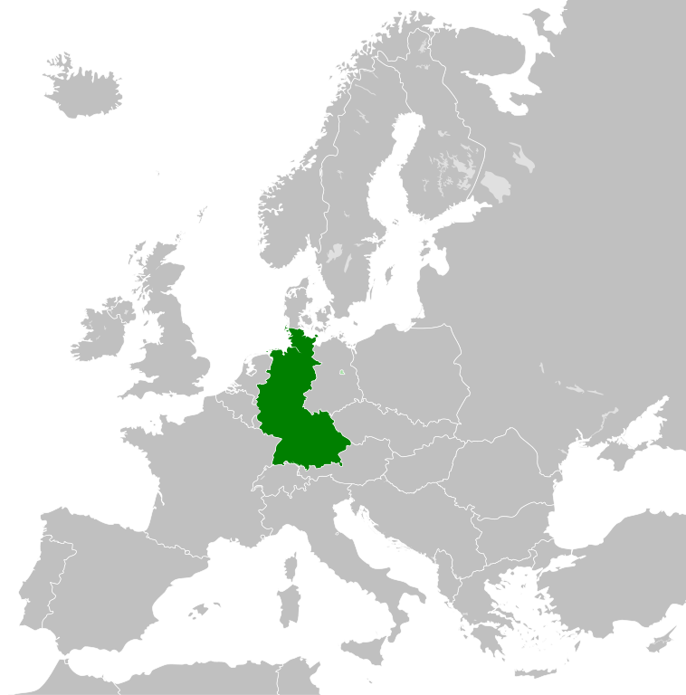
- 2011-10-30T04:43:42Z Alphathon 450x456 (485146 Bytes) == {{int:filedesc}} == {{Information |Description={{en|Blank map of Europe showing national borders as they stood from 1956-1990.}} |Source=*[[:File:Blank_map_of_Europe.svg|]] |Date=2011-10-30 04:42 (UTC) |Author=*[[:File:Bla
പ്രമാണ നാൾവഴി
ഏതെങ്കിലും തീയതി/സമയ കണ്ണിയിൽ ഞെക്കിയാൽ പ്രസ്തുതസമയത്ത് ഈ പ്രമാണം എങ്ങനെയായിരുന്നു എന്നു കാണാം.
| തീയതി/സമയം | ലഘുചിത്രം | അളവുകൾ | ഉപയോക്താവ് | അഭിപ്രായം | |
|---|---|---|---|---|---|
| നിലവിലുള്ളത് | 01:31, 28 സെപ്റ്റംബർ 2018 | | 450 × 456 (471 കെ.ബി.) | FelipeRev | Se incluye Berlín Oeste pero con un color diferente, para marcar que pertenecía a su espacio económico |
| 04:04, 15 ജൂലൈ 2015 |  | 450 × 456 (476 കെ.ബി.) | Elevatorrailfan | Breaking apart West Germany and West Berlin paths. | |
| 01:43, 10 ഡിസംബർ 2014 |  | 450 × 456 (476 കെ.ബി.) | Elevatorrailfan | West Berlin was not part of West Germany. | |
| 00:39, 26 നവംബർ 2011 |  | 450 × 456 (474 കെ.ബി.) | StalwartUK | == {{int:filedesc}} == {{Information |Description={{en|Map of West Germany (Federal Republic of Germany) as it was from 1949-1990. Surrounding countries accurate from 1956-1990.}} |Source=*[[:File:Blank_map_of_Europe_1956-1990.svg|Bla |
പ്രമാണത്തിന്റെ ഉപയോഗം
താഴെ കാണുന്ന താളിൽ ഈ ചിത്രം ഉപയോഗിക്കുന്നു:
പ്രമാണത്തിന്റെ ആഗോള ഉപയോഗം
താഴെ കൊടുത്തിരിക്കുന്ന മറ്റ് വിക്കികൾ ഈ പ്രമാണം ഉപയോഗിക്കുന്നു:
- af.wikipedia.org സംരംഭത്തിലെ ഉപയോഗം
- an.wikipedia.org സംരംഭത്തിലെ ഉപയോഗം
- ar.wikipedia.org സംരംഭത്തിലെ ഉപയോഗം
- ast.wikipedia.org സംരംഭത്തിലെ ഉപയോഗം
- be.wikipedia.org സംരംഭത്തിലെ ഉപയോഗം
- bn.wikipedia.org സംരംഭത്തിലെ ഉപയോഗം
- bs.wikipedia.org സംരംഭത്തിലെ ഉപയോഗം
- ca.wikipedia.org സംരംഭത്തിലെ ഉപയോഗം
- cs.wikipedia.org സംരംഭത്തിലെ ഉപയോഗം
- da.wikipedia.org സംരംഭത്തിലെ ഉപയോഗം
- el.wikipedia.org സംരംഭത്തിലെ ഉപയോഗം
- en.wikipedia.org സംരംഭത്തിലെ ഉപയോഗം
- eo.wikipedia.org സംരംഭത്തിലെ ഉപയോഗം
- es.wikipedia.org സംരംഭത്തിലെ ഉപയോഗം
- eu.wikipedia.org സംരംഭത്തിലെ ഉപയോഗം
- fi.wikipedia.org സംരംഭത്തിലെ ഉപയോഗം
- fr.wikipedia.org സംരംഭത്തിലെ ഉപയോഗം
- fr.wiktionary.org സംരംഭത്തിലെ ഉപയോഗം
- ga.wikipedia.org സംരംഭത്തിലെ ഉപയോഗം
- gl.wikipedia.org സംരംഭത്തിലെ ഉപയോഗം
- gv.wikipedia.org സംരംഭത്തിലെ ഉപയോഗം
- ha.wikipedia.org സംരംഭത്തിലെ ഉപയോഗം
- he.wikipedia.org സംരംഭത്തിലെ ഉപയോഗം
- hi.wikipedia.org സംരംഭത്തിലെ ഉപയോഗം
- hr.wikipedia.org സംരംഭത്തിലെ ഉപയോഗം
- ia.wikipedia.org സംരംഭത്തിലെ ഉപയോഗം
- id.wikipedia.org സംരംഭത്തിലെ ഉപയോഗം
- io.wikipedia.org സംരംഭത്തിലെ ഉപയോഗം
- it.wikipedia.org സംരംഭത്തിലെ ഉപയോഗം
- ja.wikipedia.org സംരംഭത്തിലെ ഉപയോഗം
- ka.wikipedia.org സംരംഭത്തിലെ ഉപയോഗം
- ko.wikipedia.org സംരംഭത്തിലെ ഉപയോഗം
- ku.wikipedia.org സംരംഭത്തിലെ ഉപയോഗം
- lij.wikipedia.org സംരംഭത്തിലെ ഉപയോഗം
- lld.wikipedia.org സംരംഭത്തിലെ ഉപയോഗം
- lmo.wikipedia.org സംരംഭത്തിലെ ഉപയോഗം
- lt.wikipedia.org സംരംഭത്തിലെ ഉപയോഗം
- lv.wikipedia.org സംരംഭത്തിലെ ഉപയോഗം
- mk.wikipedia.org സംരംഭത്തിലെ ഉപയോഗം
- mr.wikipedia.org സംരംഭത്തിലെ ഉപയോഗം
- ms.wikipedia.org സംരംഭത്തിലെ ഉപയോഗം
- nl.wikipedia.org സംരംഭത്തിലെ ഉപയോഗം
ഈ പ്രമാണത്തിന്റെ കൂടുതൽ ആഗോള ഉപയോഗം കാണുക.