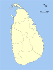
ശ്രീലങ്കയിലെ പ്രവിശ്യകൾ
ശ്രീലങ്കയിലെ പ്രവിശ്യകൾആണ് ആദ്യ തല ഭരണ വിഭാഗം. 1833ലെ ബ്രിട്ടിഷ് ഭരണകാലത്താണ് ശ്രീലങ്കയെ (അന്ന് സിലോൺ എന്നാണ് ഈ രാജ്യം അറിയപ്പെട്ടത്) പ്രവിശ്യകളായി ആദ്യമായി തിരിച്ചത്. അടുത്ത നൂറ്റാണ്ടിൽ ഈ പ്രവിശ്യകളുടെ മിക്ക ഭരണാധികാരങ്ങളും ജില്ലകൾക്കു കൈമാറി. ഇരുപതാം നൂറ്റാണ്ടിന്റെ മദ്ധ്യത്തോടെ പ്രവിശ്യകൾ വെറും ആലങ്കാരികവിഭാഗമായി മാറി. 1987ൽ വികേന്ദ്രീകരണത്തിനു വേണ്ടിയുള്ള വർഷങ്ങളോളമുള്ള ജനകീയാവശ്യഫലമായി 1978ലെ ശ്രീലങ്കയുടെ ഭരണഘടനാ പ്രകാരം പ്രവിശ്യാകൗൺസിലുകൾ രൂപീകരിക്കപ്പെട്ടു. [1][2]ഇപ്പോൾ ശ്രീലങ്കയിൽ ഒമ്പത് പ്രവിശ്യകളുണ്ട്.
| Province පළාත மாகாணம் | |
|---|---|
 | |
| Category | First level administrative division |
| Location | Sri Lanka |
| Created | 1 October 1833 |
| എണ്ണം | 9 (as of 1 January 2007) |
| ജനസംഖ്യ | 1,061,315–5,851,130 |
| വിസ്തീർണ്ണം | 3,684–10,472 km² |
| സർക്കാർ | Provincial council |
| സബ്ഡിവിഷനുകൾ | District |
ചരിത്രം തിരുത്തുക
അനുരാധാപുര രാജ്യം തിരുത്തുക

ബ്രിട്ടിഷ് സിലോൺ തിരുത്തുക
- കാണ്ടി രാജ്യം, ബ്രിട്ടിഷ് സിലോൺ കാണുക.
ബ്രിട്ടിഷ് 1815ൽ ശ്രീലങ്ക മുഴുവൻ കീഴടക്കിക്കഴിഞ്ഞപ്പോൾ അവർ ശ്രീലങ്കയെ വംശപരമായി മൂന്ന് ഭരണവിഭാഗമായി തരംതിരിച്ചു: Low Country Sinhalese, Kandyan Sinhalese and Tamil എന്നിങ്ങനെ. ബ്രിട്ടിഷ് സർക്കാർ, നിലവിലുള്ള കോളനിസർക്കാരിനെയും അതിന്റെ ഭരണ തലത്തെയും വിലയിരുത്താൻ 1829ൽ കോൾബ്രൂക്ക്-കാമെറോൺ കമ്മിഷനെ നിയമിച്ചു. ആ കമ്മിഷൻ, നിലവിലുള്ള മൂന്ന് ഭരണവിഭാഗങ്ങളെ ഒന്നിച്ചുചേർത്ത് അതിനെ അഞ്ചു പ്രവിശ്യകളായി തിരിക്കാൻ ശുപാർശചെയ്തു. അതിനനുസരിച്ച്, 1833 ഒക്ടോബറിൽ ഒരു ഭരണത്തിനുകീഴിൽ അഞ്ചു പ്രവീശ്യകൾ നിലവിൽവന്നു. [3] Accordingly, on 1 October 1833 five provinces under one administration came into being:[4][5][6][7]
- മദ്ധ്യ പ്രവിശ്യ -
- കിഴക്കൻ പ്രവിശ്യ -
- വടക്കൻ പ്രവിശ്യ -
- തെക്കൻ പ്രവിശ്യ
- പടിഞ്ഞാറൻ പ്രവിശ്യ
അടുത്ത അൻപതു വർഷംകൊണ്ട് അടുത്ത 4 പ്രവിശ്യകൾകൂടി നിലവിൽവന്നു. അങ്ങനെ ആകെ ഒമ്പതു പ്രവിശ്യകൾ നിലവിൽവന്നു: [6][7][8]
- വടക്കുപടിഞ്ഞാറൻ പ്രവിശ്യ
- ഉത്തരമദ്ധ്യ പ്രവിശ്യ
- ഉവ പ്രവിശ്യ
- ശബരഗമുവ പ്രവിശ്യ
ശ്രീലങ്ക തിരുത്തുക
-
 1833 - 1845
 -
 1845 - 1873
 -
 1873 - 1886
 -
 1886 - 1889
 -
 1889 - Present


പ്രവിശ്യകൾ തിരുത്തുക
സമകാലികം തിരുത്തുക
2012ലെ ശ്രീലങ്ക സെൻസസ് പ്രകാരമുള്ളതാണ് ഇവിടെക്കൊടുത്ത വിവരങ്ങൾ.
| Province | Area map | Provincial capital |
Date Created |
Land area in km2 (mi2)[9] |
Inland water area in km2 (mi2)[9] |
Total area in km2 (mi2)[9] |
Population (2012)[10] |
Population density per km2 (per mi2)[i] |
|---|---|---|---|---|---|---|---|---|

|
Kandy | 1 ഒക്ടോബർ 1833 | 5,575 (2,153) | 99 (38) | 5,674 (2,191) | 2,571,557 | 461 (1,190) | |

|
Trincomalee | 1 ഒക്ടോബർ 1833 | 9,361 (3,614) | 635 (245) | 9,996 (3,859) | 1,555,510 | 166 (430) | |

|
Anuradhapura | 1873 | 9,741 (3,761) | 731 (282) | 10,472 (4,043) | 1,266,663 | 130 (340) | |

|
Jaffna | 1 ഒക്ടോബർ 1833 | 8,290 (3,200) | 594 (229) | 8,884 (3,430) | 1,061,315 | 128 (330) | |

|
Kurunegala | 1845 | 7,506 (2,898) | 382 (147) | 7,888 (3,046) | 2,380,861 | 317 (820) | |

|
Ratnapura | 1889 | 4,921 (1,900) | 47 (18) | 4,968 (1,918) | 1,928,655 | 392 (1,020) | |

|
Galle | 1 ഒക്ടോബർ 1833 | 5,383 (2,078) | 161 (62) | 5,544 (2,141) | 2,477,285 | 460 (1,200) | |

|
Badulla | 1886 | 8,335 (3,218) | 165 (64) | 8,500 (3,300) | 1,266,463 | 152 (390) | |

|
Colombo | 1 ഒക്ടോബർ 1833 | 3,593 (1,387) | 91 (35) | 3,684 (1,422) | 5,851,130 | 1,628 (4,220) | |
| Total | 62,705 (24,211) | 2,905 (1,122) | 65,610 (25,330) | 20,359,439 | 325 (840) |
See also തിരുത്തുക
കുറിപ്പുകൾ തിരുത്തുക
- ↑ Population density has been calculated using the land area rather than the total area.
അവലംബം തിരുത്തുക
- ↑ Law, Gwillim (2010). "Provinces of Sri Lanka". statoids.com. Retrieved 19 January 2010.
- ↑ 2.0 2.1 "Introduction". Provincial Councils. Government of Sri Lanka. Archived from the original on 2009-07-07. Retrieved 16 January 2010.
- ↑ ഉദ്ധരിച്ചതിൽ പിഴവ്: അസാധുവായ
<ref>ടാഗ്;LoCഎന്ന പേരിലെ അവലംബങ്ങൾക്ക് എഴുത്തൊന്നും നൽകിയിട്ടില്ല. - ↑ Mills, Lennox A. (1933). Ceylon Under British Rule 1795-1932. London: Oxford University Press/Humphrey S. Milford. p. 68. Retrieved 16 August 2009.
- ↑ Mendis 1946, പുറം. 39.
- ↑ 6.0 6.1 Samarasinghe, L. M. (21 March 2003). "River basins as administrative divisions". Daily News (Sri Lanka).
- ↑ 7.0 7.1 "Sinhala Colonisation in the Hereditary Tamil Regions of the Island of Sri Lanka". UN Commission on Human Rights 56th Sessions: March/April 2000. Tamil Nation. Archived from the original on 2016-03-05. Retrieved 16 August 2009.
- ↑ Karalliyadda, S. B. (4 February 2009). "Independence Struggle for a Hundred and Thirty Three Years". Daily News (Sri Lanka). Retrieved 16 August 2009.
- ↑ 9.0 9.1 9.2 "Table 1.1: Area of Sri Lanka by province and district" (PDF). Statistical Abstract 2014. Department of Census and Statistics, Sri Lanka.
- ↑ "Census of Population and Housing of Sri Lanka, 2012 - Table A1: Population by district,sex and sector" (PDF). Department of Census & Statistics, Sri Lanka. Archived from the original (PDF) on 2014-12-28. Retrieved 2016-07-19.
ഗ്രന്ഥസൂചി തിരുത്തുക
- Mendis, G. C. (1946). Ceylon Under the British (2nd (Revised) ed.). Colombo: Colombo Apothecaries' Company.